You are here: Home > Network List > TA - USArray Transportable Network (new EarthScope stations) Stations List
> Station B18K Kokolik River, AK, USA > Earthquake Result Viewer
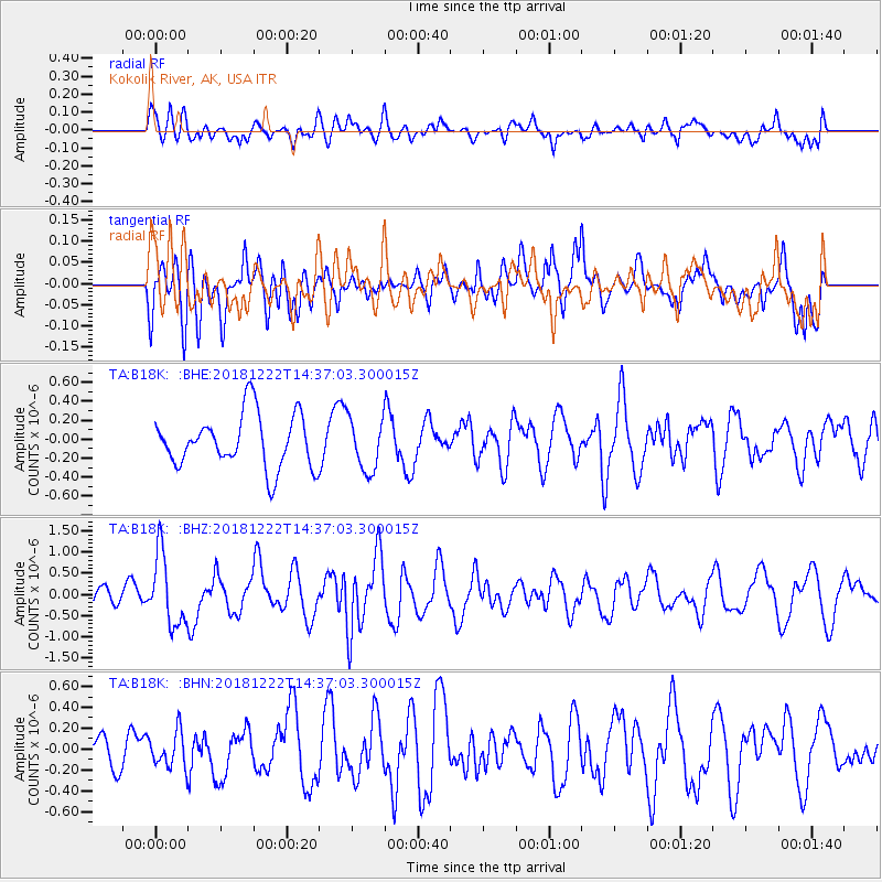
B18K Kokolik River, AK, USA - Earthquake Result Viewer
*The percent match for this event was below the threshold and hence no stack was calculated.
| Earthquake location: |
Vanuatu Islands |
| Earthquake latitude/longitude: |
-13.4/166.7 |
| Earthquake time(UTC): |
2018/12/22 (356) 14:25:02 GMT |
| Earthquake Depth: |
48 km |
| Earthquake Magnitude: |
6.0 Mww |
| Earthquake Catalog/Contributor: |
NEIC PDE/us |
|
| Network: |
TA USArray Transportable Network (new EarthScope stations) |
| Station: |
B18K Kokolik River, AK, USA |
| Lat/Lon: |
69.36 N/161.80 W |
| Elevation: |
222 m |
|
| Distance: |
85.5 deg |
| Az: |
10.711 deg |
| Baz: |
210.671 deg |
| Ray Param: |
$rayparam |
*The percent match for this event was below the threshold and hence was not used in the summary stack. |
|
| Radial Match: |
46.85689 % |
| Radial Bump: |
400 |
| Transverse Match: |
51.669865 % |
| Transverse Bump: |
400 |
| SOD ConfigId: |
13570011 |
| Insert Time: |
2019-05-02 03:39:51.570 +0000 |
| GWidth: |
2.5 |
| Max Bumps: |
400 |
| Tol: |
0.001 |
|
Signal To Noise
| Channel | StoN | STA | LTA |
| TA:B18K: :BHZ:20181222T14:37:03.300015Z | 3.0348194 | 8.382224E-7 | 2.7620175E-7 |
| TA:B18K: :BHN:20181222T14:37:03.300015Z | 0.7640304 | 1.6713065E-7 | 2.1874868E-7 |
| TA:B18K: :BHE:20181222T14:37:03.300015Z | 1.0380079 | 2.930584E-7 | 2.8232773E-7 |
| Arrivals |
| Ps | |
| PpPs | |
| PsPs/PpSs | |


