You are here: Home > Network List > TA - USArray Transportable Network (new EarthScope stations) Stations List
> Station C16K Lisburne Hills, AK, USA > Earthquake Result Viewer
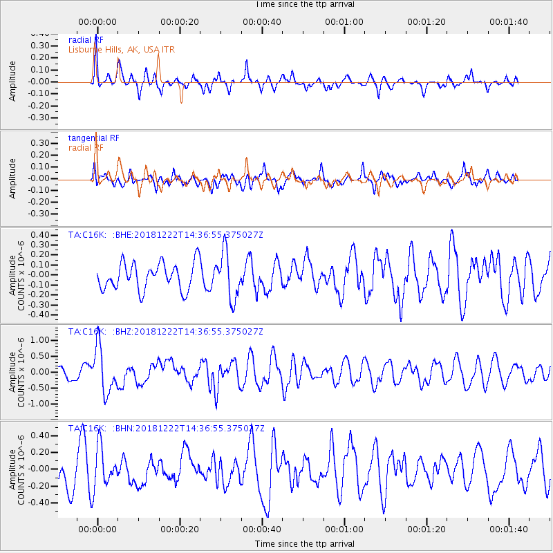
C16K Lisburne Hills, AK, USA - Earthquake Result Viewer
*The percent match for this event was below the threshold and hence no stack was calculated.
| Earthquake location: |
Vanuatu Islands |
| Earthquake latitude/longitude: |
-13.4/166.7 |
| Earthquake time(UTC): |
2018/12/22 (356) 14:25:02 GMT |
| Earthquake Depth: |
48 km |
| Earthquake Magnitude: |
6.0 Mww |
| Earthquake Catalog/Contributor: |
NEIC PDE/us |
|
| Network: |
TA USArray Transportable Network (new EarthScope stations) |
| Station: |
C16K Lisburne Hills, AK, USA |
| Lat/Lon: |
68.27 N/165.34 W |
| Elevation: |
102 m |
|
| Distance: |
83.9 deg |
| Az: |
10.113 deg |
| Baz: |
207.316 deg |
| Ray Param: |
$rayparam |
*The percent match for this event was below the threshold and hence was not used in the summary stack. |
|
| Radial Match: |
59.00379 % |
| Radial Bump: |
400 |
| Transverse Match: |
51.91779 % |
| Transverse Bump: |
400 |
| SOD ConfigId: |
13570011 |
| Insert Time: |
2019-05-02 03:39:55.992 +0000 |
| GWidth: |
2.5 |
| Max Bumps: |
400 |
| Tol: |
0.001 |
|
Signal To Noise
| Channel | StoN | STA | LTA |
| TA:C16K: :BHZ:20181222T14:36:55.375027Z | 4.5634146 | 7.4588866E-7 | 1.6344968E-7 |
| TA:C16K: :BHN:20181222T14:36:55.375027Z | 1.3079343 | 2.3657722E-7 | 1.8087852E-7 |
| TA:C16K: :BHE:20181222T14:36:55.375027Z | 1.7812141 | 2.4101666E-7 | 1.3531032E-7 |
| Arrivals |
| Ps | |
| PpPs | |
| PsPs/PpSs | |


