E17A Martinsdale, MT, USA - Earthquake Result Viewer
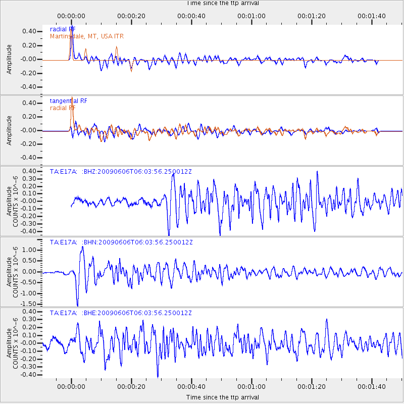
Earthquake location: Near East Coast Of Honshu, Japan
Earthquake latitude/longitude: 35.5/140.9
Earthquake time(UTC): 2009/06/06 (157) 05:52:43 GMT
Earthquake Depth: 34 km
Earthquake Magnitude: 5.8 MB, 5.4 MS, 5.8 MW, 5.7 MW
Earthquake Catalog/Contributor: WHDF/NEIC
Network: TA USArray Transportable Network (new EarthScope stations)
Station: E17A Martinsdale, MT, USA
Lat/Lon: 46.46 N/110.86 W
Elevation: 1835 m
Distance: 76.0 deg
Az: 42.573 deg
Baz: 306.991 deg
Ray Param: 0.0512073
Estimated Moho Depth: 18.75 km
Estimated Crust Vp/Vs: 1.80
Assumed Crust Vp: 6.306 km/s
Estimated Crust Vs: 3.503 km/s
Estimated Crust Poisson's Ratio: 0.28
Radial Match: 88.738075 %
Radial Bump: 400
Transverse Match: 81.71024 %
Transverse Bump: 400
SOD ConfigId: 2648
Insert Time: 2010-03-06 18:51:44.922 +0000
GWidth: 2.5
Max Bumps: 400
Tol: 0.001

Signal To Noise

ChannelStoNSTALTA
TA:E17A: :BHN:20090606T06:03:56.250012Z18.2158057.137683E-73.9184012E-8
TA:E17A: :BHE:20090606T06:03:56.250012Z2.56297421.3095234E-75.1093895E-8
TA:E17A: :BHZ:20090606T06:03:56.250012Z6.25568342.1233956E-73.394346E-8
Arrivals
Ps2.5 SECOND
PpPs8.1 SECOND
PsPs/PpSs11 SECOND