You are here: Home > Network List > TA - USArray Transportable Network (new EarthScope stations) Stations List
> Station G16K Koyuk River, AK, USA > Earthquake Result Viewer
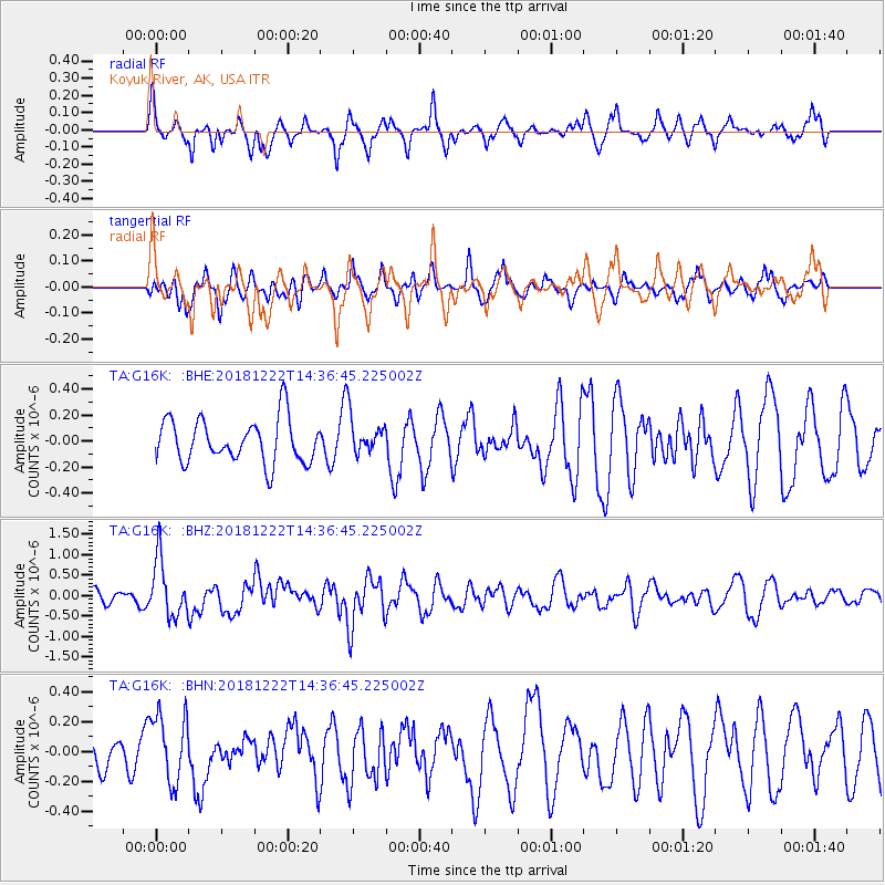
G16K Koyuk River, AK, USA - Earthquake Result Viewer
*The percent match for this event was below the threshold and hence no stack was calculated.
| Earthquake location: |
Vanuatu Islands |
| Earthquake latitude/longitude: |
-13.4/166.7 |
| Earthquake time(UTC): |
2018/12/22 (356) 14:25:02 GMT |
| Earthquake Depth: |
48 km |
| Earthquake Magnitude: |
6.0 Mww |
| Earthquake Catalog/Contributor: |
NEIC PDE/us |
|
| Network: |
TA USArray Transportable Network (new EarthScope stations) |
| Station: |
G16K Koyuk River, AK, USA |
| Lat/Lon: |
65.39 N/162.35 W |
| Elevation: |
169 m |
|
| Distance: |
82.0 deg |
| Az: |
12.563 deg |
| Baz: |
210.363 deg |
| Ray Param: |
$rayparam |
*The percent match for this event was below the threshold and hence was not used in the summary stack. |
|
| Radial Match: |
67.679085 % |
| Radial Bump: |
359 |
| Transverse Match: |
61.77628 % |
| Transverse Bump: |
342 |
| SOD ConfigId: |
13570011 |
| Insert Time: |
2019-05-02 03:40:19.961 +0000 |
| GWidth: |
2.5 |
| Max Bumps: |
400 |
| Tol: |
0.001 |
|
Signal To Noise
| Channel | StoN | STA | LTA |
| TA:G16K: :BHZ:20181222T14:36:45.225002Z | 3.3660314 | 7.02726E-7 | 2.087699E-7 |
| TA:G16K: :BHN:20181222T14:36:45.225002Z | 1.3101354 | 2.268421E-7 | 1.7314403E-7 |
| TA:G16K: :BHE:20181222T14:36:45.225002Z | 0.55386883 | 9.298911E-8 | 1.6789012E-7 |
| Arrivals |
| Ps | |
| PpPs | |
| PsPs/PpSs | |


