E17A Martinsdale, MT, USA - Earthquake Result Viewer
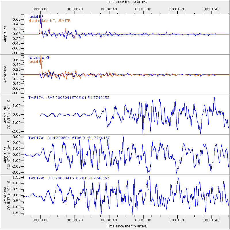
Earthquake location: Andreanof Islands, Aleutian Is.
Earthquake latitude/longitude: 51.9/-179.2
Earthquake time(UTC): 2008/04/16 (107) 05:54:19 GMT
Earthquake Depth: 13 km
Earthquake Magnitude: 6.1 MB, 6.5 MS, 6.6 MW, 6.6 MW
Earthquake Catalog/Contributor: WHDF/NEIC
Network: TA USArray Transportable Network (new EarthScope stations)
Station: E17A Martinsdale, MT, USA
Lat/Lon: 46.46 N/110.86 W
Elevation: 1835 m
Distance: 43.5 deg
Az: 68.931 deg
Baz: 303.195 deg
Ray Param: 0.07250609
Estimated Moho Depth: 34.75 km
Estimated Crust Vp/Vs: 1.82
Assumed Crust Vp: 6.306 km/s
Estimated Crust Vs: 3.474 km/s
Estimated Crust Poisson's Ratio: 0.28
Radial Match: 95.95663 %
Radial Bump: 400
Transverse Match: 81.22876 %
Transverse Bump: 400
SOD ConfigId: 2504
Insert Time: 2010-03-06 18:52:19.884 +0000
GWidth: 2.5
Max Bumps: 400
Tol: 0.001

Signal To Noise

ChannelStoNSTALTA
TA:E17A: :BHN:20080416T06:01:51.774015Z7.5825516.818794E-78.992744E-8
TA:E17A: :BHE:20080416T06:01:51.774015Z2.63956242.5447952E-79.640974E-8
TA:E17A: :BHZ:20080416T06:01:51.774015Z2.7806093.3563038E-71.2070392E-7
Arrivals
Ps4.8 SECOND
PpPs15 SECOND
PsPs/PpSs19 SECOND