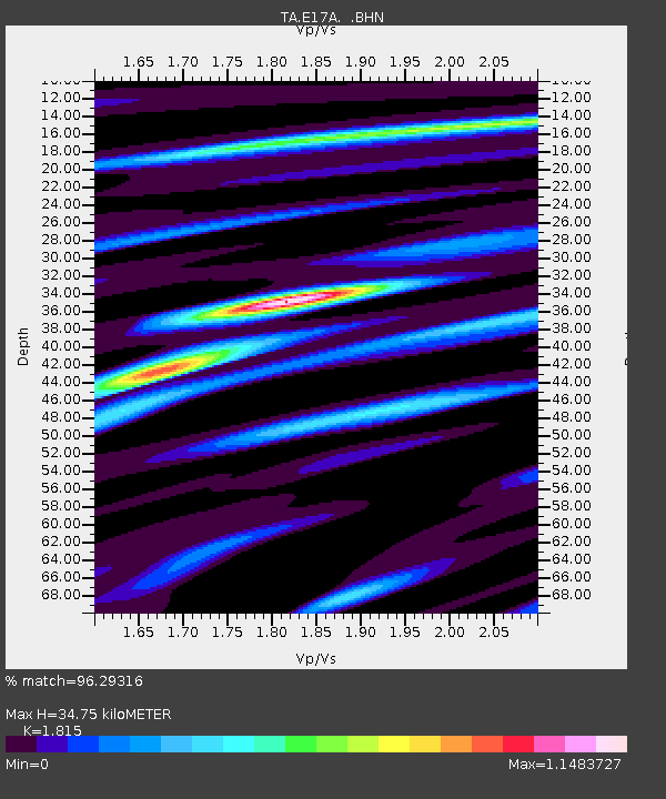
E17A Martinsdale, MT, USA - Earthquake Result Viewer
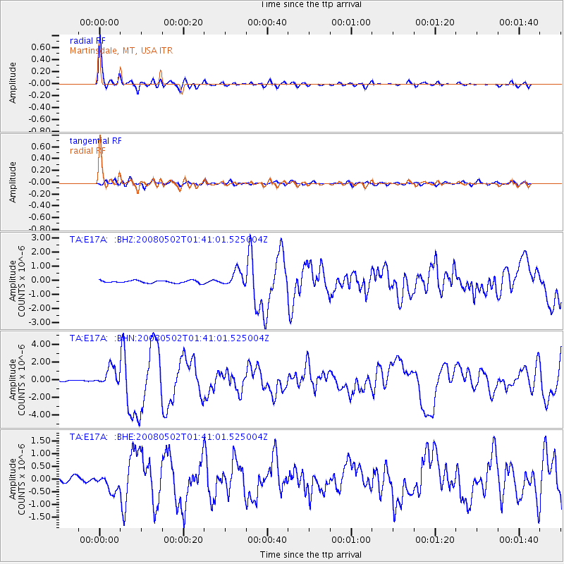
Earthquake location: Andreanof Islands, Aleutian Is.
Earthquake latitude/longitude: 51.9/-177.5
Earthquake time(UTC): 2008/05/02 (123) 01:33:37 GMT
Earthquake Depth: 14 km
Earthquake Magnitude: 6.3 MB, 6.8 MS, 6.6 MW, 6.6 MW
Earthquake Catalog/Contributor: WHDF/NEIC
Network: TA USArray Transportable Network (new EarthScope stations)
Station: E17A Martinsdale, MT, USA
Lat/Lon: 46.46 N/110.86 W
Elevation: 1835 m
Distance: 42.6 deg
Az: 69.818 deg
Baz: 302.651 deg
Ray Param: 0.07309902
Estimated Moho Depth: 34.75 km
Estimated Crust Vp/Vs: 1.82
Assumed Crust Vp: 6.306 km/s
Estimated Crust Vs: 3.474 km/s
Estimated Crust Poisson's Ratio: 0.28
Radial Match: 96.29316 %
Radial Bump: 383
Transverse Match: 67.28217 %
Transverse Bump: 400
SOD ConfigId: 2504
Insert Time: 2010-03-06 18:52:21.355 +0000
GWidth: 2.5
Max Bumps: 400
Tol: 0.001

Signal To Noise

ChannelStoNSTALTA
TA:E17A: :BHN:20080502T01:41:01.525004Z14.0756221.0546486E-67.4927314E-8
TA:E17A: :BHE:20080502T01:41:01.525004Z3.5767843.375817E-79.4381356E-8
TA:E17A: :BHZ:20080502T01:41:01.525004Z6.29358635.5570086E-78.829638E-8
Arrivals
Ps4.8 SECOND
PpPs15 SECOND
PsPs/PpSs19 SECOND