You are here: Home > Network List > CI - Caltech Regional Seismic Network Stations List
> Station MPM Manuel Prospect Mine, California, USA > Earthquake Result Viewer
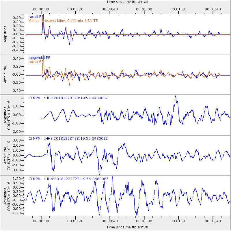
MPM Manuel Prospect Mine, California, USA - Earthquake Result Viewer
*The percent match for this event was below the threshold and hence no stack was calculated.
| Earthquake location: |
Tonga Islands |
| Earthquake latitude/longitude: |
-20.4/-175.1 |
| Earthquake time(UTC): |
2018/12/23 (357) 23:08:40 GMT |
| Earthquake Depth: |
100 km |
| Earthquake Magnitude: |
6.4 mww |
| Earthquake Catalog/Contributor: |
NEIC PDE/us |
|
| Network: |
CI Caltech Regional Seismic Network |
| Station: |
MPM Manuel Prospect Mine, California, USA |
| Lat/Lon: |
36.06 N/117.49 W |
| Elevation: |
185 m |
|
| Distance: |
78.2 deg |
| Az: |
44.343 deg |
| Baz: |
234.025 deg |
| Ray Param: |
$rayparam |
*The percent match for this event was below the threshold and hence was not used in the summary stack. |
|
| Radial Match: |
79.084404 % |
| Radial Bump: |
400 |
| Transverse Match: |
67.76597 % |
| Transverse Bump: |
400 |
| SOD ConfigId: |
13570011 |
| Insert Time: |
2019-05-02 03:51:54.956 +0000 |
| GWidth: |
2.5 |
| Max Bumps: |
400 |
| Tol: |
0.001 |
|
Signal To Noise
| Channel | StoN | STA | LTA |
| CI:MPM: :HHZ:20181223T23:19:59.048008Z | 5.8645444 | 8.689679E-7 | 1.4817313E-7 |
| CI:MPM: :HHN:20181223T23:19:59.048008Z | 1.3242991 | 3.8752464E-7 | 2.9262623E-7 |
| CI:MPM: :HHE:20181223T23:19:59.048008Z | 0.5956702 | 2.3275334E-7 | 3.9074192E-7 |
| Arrivals |
| Ps | |
| PpPs | |
| PsPs/PpSs | |


