You are here: Home > Network List > CI - Caltech Regional Seismic Network Stations List
> Station MPP McPhearson Peak > Earthquake Result Viewer
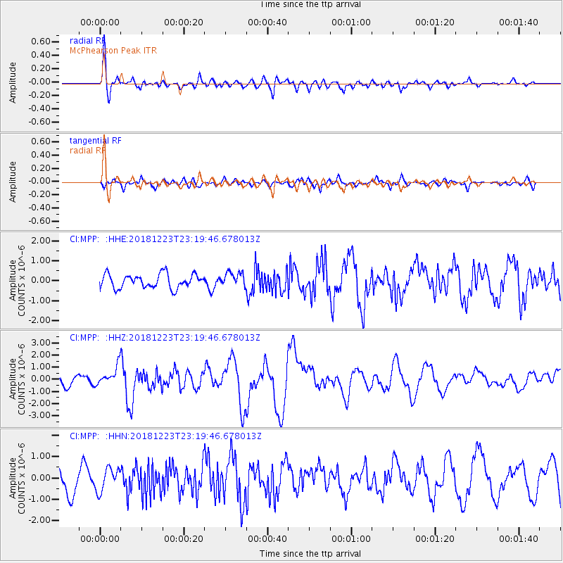
MPP McPhearson Peak - Earthquake Result Viewer
*The percent match for this event was below the threshold and hence no stack was calculated.
| Earthquake location: |
Tonga Islands |
| Earthquake latitude/longitude: |
-20.4/-175.1 |
| Earthquake time(UTC): |
2018/12/23 (357) 23:08:40 GMT |
| Earthquake Depth: |
100 km |
| Earthquake Magnitude: |
6.4 mww |
| Earthquake Catalog/Contributor: |
NEIC PDE/us |
|
| Network: |
CI Caltech Regional Seismic Network |
| Station: |
MPP McPhearson Peak |
| Lat/Lon: |
34.89 N/119.81 W |
| Elevation: |
1739 m |
|
| Distance: |
76.0 deg |
| Az: |
44.14 deg |
| Baz: |
232.636 deg |
| Ray Param: |
$rayparam |
*The percent match for this event was below the threshold and hence was not used in the summary stack. |
|
| Radial Match: |
68.01462 % |
| Radial Bump: |
400 |
| Transverse Match: |
56.733574 % |
| Transverse Bump: |
400 |
| SOD ConfigId: |
13570011 |
| Insert Time: |
2019-05-02 03:51:55.105 +0000 |
| GWidth: |
2.5 |
| Max Bumps: |
400 |
| Tol: |
0.001 |
|
Signal To Noise
| Channel | StoN | STA | LTA |
| CI:MPP: :HHZ:20181223T23:19:46.678013Z | 1.9140581 | 8.117841E-7 | 4.2411676E-7 |
| CI:MPP: :HHN:20181223T23:19:46.678013Z | 1.01478 | 5.463918E-7 | 5.384337E-7 |
| CI:MPP: :HHE:20181223T23:19:46.678013Z | 0.8848708 | 3.1588698E-7 | 3.5698656E-7 |
| Arrivals |
| Ps | |
| PpPs | |
| PsPs/PpSs | |


