You are here: Home > Network List > CI - Caltech Regional Seismic Network Stations List
> Station SMM Simmler, CA, USA > Earthquake Result Viewer
SMM Simmler, CA, USA - Earthquake Result Viewer
*The percent match for this event was below the threshold and hence no stack was calculated.
| Earthquake location: |
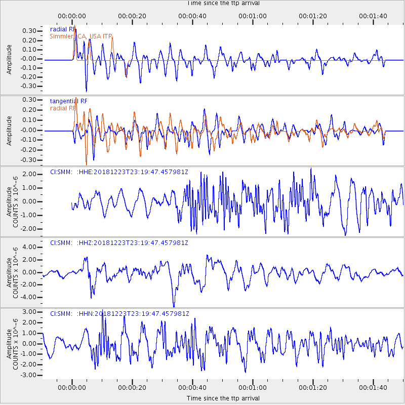
Tonga Islands |
| Earthquake latitude/longitude: |
-20.4/-175.1 |
| Earthquake time(UTC): |
2018/12/23 (357) 23:08:40 GMT |
| Earthquake Depth: |
100 km |
| Earthquake Magnitude: |
6.4 mww |
| Earthquake Catalog/Contributor: |
NEIC PDE/us |
|
| Network: |
CI Caltech Regional Seismic Network |
| Station: |
SMM Simmler, CA, USA |
| Lat/Lon: |
35.31 N/120.00 W |
| Elevation: |
599 m |
|
| Distance: |
76.1 deg |
| Az: |
43.699 deg |
| Baz: |
232.426 deg |
| Ray Param: |
$rayparam |
*The percent match for this event was below the threshold and hence was not used in the summary stack. |
|
| Radial Match: |
62.65554 % |
| Radial Bump: |
400 |
| Transverse Match: |
38.91722 % |
| Transverse Bump: |
400 |
| SOD ConfigId: |
13570011 |
| Insert Time: |
2019-05-02 03:52:08.064 +0000 |
| GWidth: |
2.5 |
| Max Bumps: |
400 |
| Tol: |
0.001 |
|
Signal To Noise
| Channel | StoN | STA | LTA |
| CI:SMM: :HHZ:20181223T23:19:47.457981Z | 1.678319 | 9.562549E-7 | 5.6976944E-7 |
| CI:SMM: :HHN:20181223T23:19:47.457981Z | 0.81108683 | 6.6139853E-7 | 8.154473E-7 |
| CI:SMM: :HHE:20181223T23:19:47.457981Z | 0.6216875 | 3.3135296E-7 | 5.329896E-7 |
| Arrivals |
| Ps | |
| PpPs | |
| PsPs/PpSs | |


