You are here: Home > Network List > US - United States National Seismic Network Stations List
> Station MSO Missoula, Montana, USA > Earthquake Result Viewer
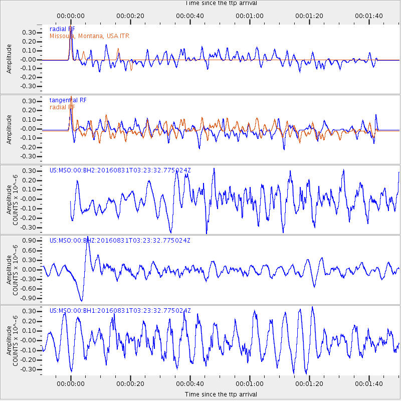
MSO Missoula, Montana, USA - Earthquake Result Viewer
*The percent match for this event was below the threshold and hence no stack was calculated.
| Earthquake location: |
New Ireland Region, P.N.G. |
| Earthquake latitude/longitude: |
-3.7/152.8 |
| Earthquake time(UTC): |
2016/08/31 (244) 03:11:36 GMT |
| Earthquake Depth: |
499 km |
| Earthquake Magnitude: |
6.7 MO |
| Earthquake Catalog/Contributor: |
NEIC PDE/NEIC ALERT |
|
| Network: |
US United States National Seismic Network |
| Station: |
MSO Missoula, Montana, USA |
| Lat/Lon: |
46.83 N/113.94 W |
| Elevation: |
1264 m |
|
| Distance: |
94.9 deg |
| Az: |
43.474 deg |
| Baz: |
269.856 deg |
| Ray Param: |
$rayparam |
*The percent match for this event was below the threshold and hence was not used in the summary stack. |
|
| Radial Match: |
57.64501 % |
| Radial Bump: |
400 |
| Transverse Match: |
57.818993 % |
| Transverse Bump: |
400 |
| SOD ConfigId: |
1634031 |
| Insert Time: |
2016-09-14 03:13:45.369 +0000 |
| GWidth: |
2.5 |
| Max Bumps: |
400 |
| Tol: |
0.001 |
|
Signal To Noise
| Channel | StoN | STA | LTA |
| US:MSO:00:BHZ:20160831T03:23:32.775024Z | 6.0658946 | 5.151293E-7 | 8.492223E-8 |
| US:MSO:00:BH1:20160831T03:23:32.775024Z | 3.0353546 | 1.8727475E-7 | 6.169782E-8 |
| US:MSO:00:BH2:20160831T03:23:32.775024Z | 1.786759 | 1.5105903E-7 | 8.454359E-8 |
| Arrivals |
| Ps | |
| PpPs | |
| PsPs/PpSs | |


