You are here: Home > Network List > TA - USArray Transportable Network (new EarthScope stations) Stations List
> Station E17A Martinsdale, MT, USA > Earthquake Result Viewer
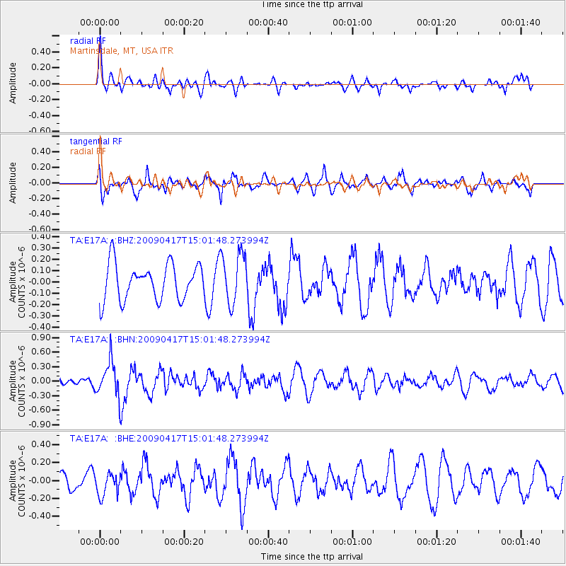
E17A Martinsdale, MT, USA - Earthquake Result Viewer
*The percent match for this event was below the threshold and hence no stack was calculated.
| Earthquake location: |
Kuril Islands |
| Earthquake latitude/longitude: |
46.2/151.7 |
| Earthquake time(UTC): |
2009/04/17 (107) 14:51:58 GMT |
| Earthquake Depth: |
49 km |
| Earthquake Magnitude: |
5.5 MB, 5.0 MS, 5.7 MW, 5.6 MW |
| Earthquake Catalog/Contributor: |
WHDF/NEIC |
|
| Network: |
TA USArray Transportable Network (new EarthScope stations) |
| Station: |
E17A Martinsdale, MT, USA |
| Lat/Lon: |
46.46 N/110.86 W |
| Elevation: |
1835 m |
|
| Distance: |
62.8 deg |
| Az: |
50.426 deg |
| Baz: |
309.202 deg |
| Ray Param: |
$rayparam |
*The percent match for this event was below the threshold and hence was not used in the summary stack. |
|
| Radial Match: |
48.433716 % |
| Radial Bump: |
394 |
| Transverse Match: |
68.72268 % |
| Transverse Bump: |
400 |
| SOD ConfigId: |
2658 |
| Insert Time: |
2010-03-06 18:53:31.360 +0000 |
| GWidth: |
2.5 |
| Max Bumps: |
400 |
| Tol: |
0.001 |
|
Signal To Noise
| Channel | StoN | STA | LTA |
| TA:E17A: :BHN:20090417T15:01:48.273994Z | 3.1737337 | 3.7062486E-7 | 1.16778814E-7 |
| TA:E17A: :BHE:20090417T15:01:48.273994Z | 1.1363726 | 1.2668693E-7 | 1.11483615E-7 |
| TA:E17A: :BHZ:20090417T15:01:48.273994Z | 1.3943349 | 2.2007922E-7 | 1.5783813E-7 |
| Arrivals |
| Ps | |
| PpPs | |
| PsPs/PpSs | |


