You are here: Home > Network List > TA - USArray Transportable Network (new EarthScope stations) Stations List
> Station E17A Martinsdale, MT, USA > Earthquake Result Viewer
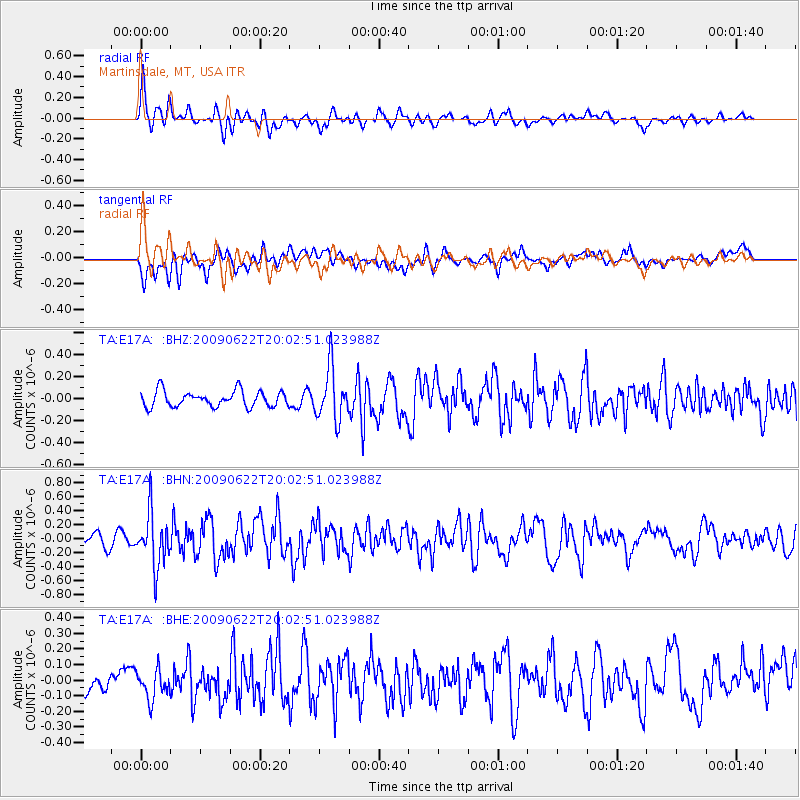
E17A Martinsdale, MT, USA - Earthquake Result Viewer
*The percent match for this event was below the threshold and hence no stack was calculated.
| Earthquake location: |
Andreanof Islands, Aleutian Is. |
| Earthquake latitude/longitude: |
51.3/-178.2 |
| Earthquake time(UTC): |
2009/06/22 (173) 19:55:24 GMT |
| Earthquake Depth: |
35 km |
| Earthquake Magnitude: |
5.6 MB, 5.6 MW, 5.6 MW |
| Earthquake Catalog/Contributor: |
WHDF/NEIC |
|
| Network: |
TA USArray Transportable Network (new EarthScope stations) |
| Station: |
E17A Martinsdale, MT, USA |
| Lat/Lon: |
46.46 N/110.86 W |
| Elevation: |
1835 m |
|
| Distance: |
43.2 deg |
| Az: |
68.859 deg |
| Baz: |
302.061 deg |
| Ray Param: |
$rayparam |
*The percent match for this event was below the threshold and hence was not used in the summary stack. |
|
| Radial Match: |
62.007126 % |
| Radial Bump: |
400 |
| Transverse Match: |
58.060974 % |
| Transverse Bump: |
400 |
| SOD ConfigId: |
2648 |
| Insert Time: |
2010-03-06 18:53:40.971 +0000 |
| GWidth: |
2.5 |
| Max Bumps: |
400 |
| Tol: |
0.001 |
|
Signal To Noise
| Channel | StoN | STA | LTA |
| TA:E17A: :BHN:20090622T20:02:51.023988Z | 4.6805477 | 3.777548E-7 | 8.070739E-8 |
| TA:E17A: :BHE:20090622T20:02:51.023988Z | 1.151646 | 9.2575306E-8 | 8.0385206E-8 |
| TA:E17A: :BHZ:20090622T20:02:51.023988Z | 3.2668455 | 2.3618318E-7 | 7.229701E-8 |
| Arrivals |
| Ps | |
| PpPs | |
| PsPs/PpSs | |


