You are here: Home > Network List > TA - USArray Transportable Network (new EarthScope stations) Stations List
> Station L15K Ungalak Mountain, AK, USA > Earthquake Result Viewer
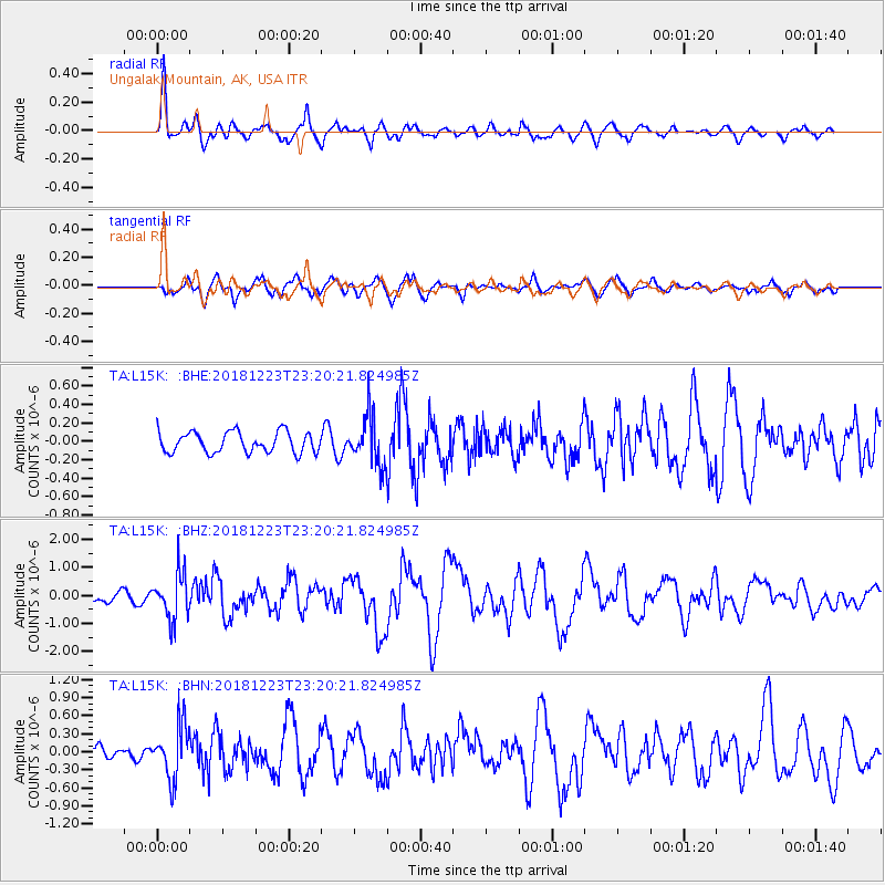
L15K Ungalak Mountain, AK, USA - Earthquake Result Viewer
*The percent match for this event was below the threshold and hence no stack was calculated.
| Earthquake location: |
Tonga Islands |
| Earthquake latitude/longitude: |
-20.4/-175.1 |
| Earthquake time(UTC): |
2018/12/23 (357) 23:08:40 GMT |
| Earthquake Depth: |
100 km |
| Earthquake Magnitude: |
6.4 mww |
| Earthquake Catalog/Contributor: |
NEIC PDE/us |
|
| Network: |
TA USArray Transportable Network (new EarthScope stations) |
| Station: |
L15K Ungalak Mountain, AK, USA |
| Lat/Lon: |
61.68 N/161.49 W |
| Elevation: |
219 m |
|
| Distance: |
82.5 deg |
| Az: |
6.497 deg |
| Baz: |
192.862 deg |
| Ray Param: |
$rayparam |
*The percent match for this event was below the threshold and hence was not used in the summary stack. |
|
| Radial Match: |
76.29896 % |
| Radial Bump: |
400 |
| Transverse Match: |
67.8773 % |
| Transverse Bump: |
400 |
| SOD ConfigId: |
13570011 |
| Insert Time: |
2019-05-02 03:56:49.157 +0000 |
| GWidth: |
2.5 |
| Max Bumps: |
400 |
| Tol: |
0.001 |
|
Signal To Noise
| Channel | StoN | STA | LTA |
| TA:L15K: :BHZ:20181223T23:20:21.824985Z | 2.8335142 | 8.1394074E-7 | 2.8725486E-7 |
| TA:L15K: :BHN:20181223T23:20:21.824985Z | 2.5706317 | 4.4588313E-7 | 1.7345275E-7 |
| TA:L15K: :BHE:20181223T23:20:21.824985Z | 1.9956762 | 2.2310874E-7 | 1.1179606E-7 |
| Arrivals |
| Ps | |
| PpPs | |
| PsPs/PpSs | |


