You are here: Home > Network List > TA - USArray Transportable Network (new EarthScope stations) Stations List
> Station E17A Martinsdale, MT, USA > Earthquake Result Viewer
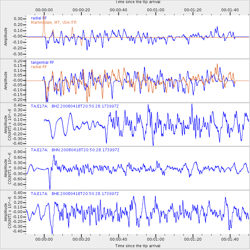
E17A Martinsdale, MT, USA - Earthquake Result Viewer
*The percent match for this event was below the threshold and hence no stack was calculated.
| Earthquake location: |
Fiji Islands Region |
| Earthquake latitude/longitude: |
-17.3/-179.0 |
| Earthquake time(UTC): |
2008/04/18 (109) 20:39:07 GMT |
| Earthquake Depth: |
554 km |
| Earthquake Magnitude: |
5.9 MB, 6.3 MW, 6.3 MW |
| Earthquake Catalog/Contributor: |
WHDF/NEIC |
|
| Network: |
TA USArray Transportable Network (new EarthScope stations) |
| Station: |
E17A Martinsdale, MT, USA |
| Lat/Lon: |
46.46 N/110.86 W |
| Elevation: |
1835 m |
|
| Distance: |
88.2 deg |
| Az: |
39.94 deg |
| Baz: |
242.502 deg |
| Ray Param: |
$rayparam |
*The percent match for this event was below the threshold and hence was not used in the summary stack. |
|
| Radial Match: |
46.240166 % |
| Radial Bump: |
400 |
| Transverse Match: |
62.297436 % |
| Transverse Bump: |
400 |
| SOD ConfigId: |
2504 |
| Insert Time: |
2010-03-06 18:53:57.383 +0000 |
| GWidth: |
2.5 |
| Max Bumps: |
400 |
| Tol: |
0.001 |
|
Signal To Noise
| Channel | StoN | STA | LTA |
| TA:E17A: :BHN:20080418T20:50:28.173997Z | 2.4695256 | 3.701756E-7 | 1.4989746E-7 |
| TA:E17A: :BHE:20080418T20:50:28.173997Z | 2.3649 | 1.9143344E-7 | 8.0947785E-8 |
| TA:E17A: :BHZ:20080418T20:50:28.173997Z | 1.0082476 | 1.25776E-7 | 1.2474713E-7 |
| Arrivals |
| Ps | |
| PpPs | |
| PsPs/PpSs | |


