You are here: Home > Network List > TA - USArray Transportable Network (new EarthScope stations) Stations List
> Station E17A Martinsdale, MT, USA > Earthquake Result Viewer
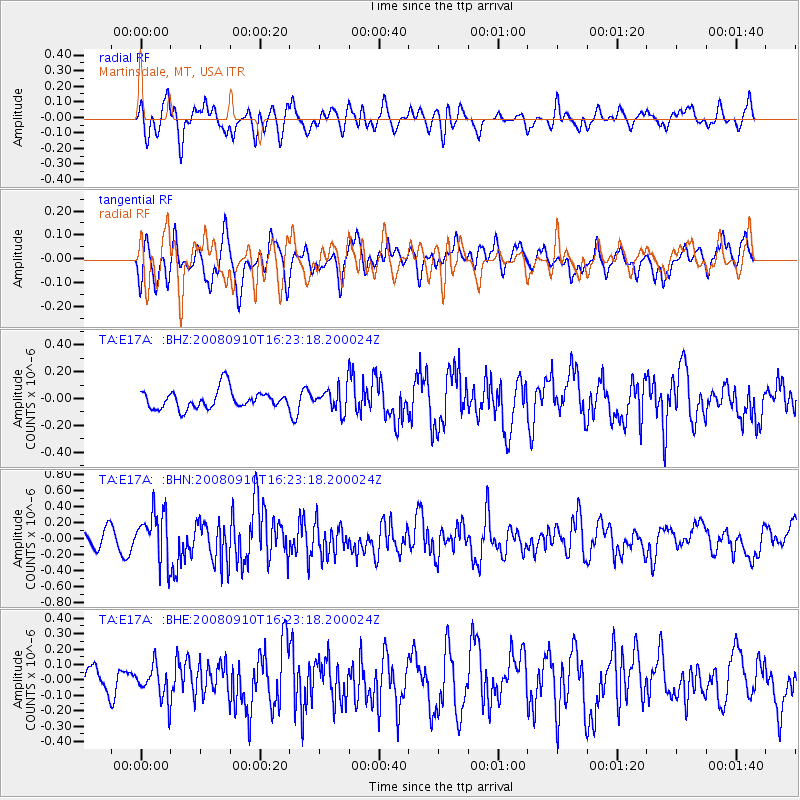
E17A Martinsdale, MT, USA - Earthquake Result Viewer
*The percent match for this event was below the threshold and hence no stack was calculated.
| Earthquake location: |
Northern Chile |
| Earthquake latitude/longitude: |
-20.3/-69.2 |
| Earthquake time(UTC): |
2008/09/10 (254) 16:12:04 GMT |
| Earthquake Depth: |
38 km |
| Earthquake Magnitude: |
5.6 MB, 5.3 MS |
| Earthquake Catalog/Contributor: |
WHDF/NEIC |
|
| Network: |
TA USArray Transportable Network (new EarthScope stations) |
| Station: |
E17A Martinsdale, MT, USA |
| Lat/Lon: |
46.46 N/110.86 W |
| Elevation: |
1835 m |
|
| Distance: |
76.3 deg |
| Az: |
331.794 deg |
| Baz: |
140.064 deg |
| Ray Param: |
$rayparam |
*The percent match for this event was below the threshold and hence was not used in the summary stack. |
|
| Radial Match: |
67.06335 % |
| Radial Bump: |
400 |
| Transverse Match: |
61.089497 % |
| Transverse Bump: |
400 |
| SOD ConfigId: |
2560 |
| Insert Time: |
2010-03-06 18:54:14.267 +0000 |
| GWidth: |
2.5 |
| Max Bumps: |
400 |
| Tol: |
0.001 |
|
Signal To Noise
| Channel | StoN | STA | LTA |
| TA:E17A: :BHN:20080910T16:23:18.200024Z | 3.0226443 | 3.1453703E-7 | 1.0406022E-7 |
| TA:E17A: :BHE:20080910T16:23:18.200024Z | 1.0162377 | 1.06005956E-7 | 1.0431216E-7 |
| TA:E17A: :BHZ:20080910T16:23:18.200024Z | 1.2860075 | 8.971608E-8 | 6.976326E-8 |
| Arrivals |
| Ps | |
| PpPs | |
| PsPs/PpSs | |


