You are here: Home > Network List > TA - USArray Transportable Network (new EarthScope stations) Stations List
> Station E17A Martinsdale, MT, USA > Earthquake Result Viewer
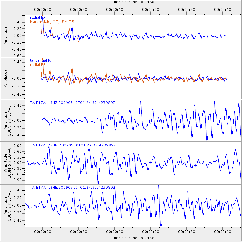
E17A Martinsdale, MT, USA - Earthquake Result Viewer
*The percent match for this event was below the threshold and hence no stack was calculated.
| Earthquake location: |
Off Coast Of Ecuador |
| Earthquake latitude/longitude: |
1.4/-85.2 |
| Earthquake time(UTC): |
2009/05/10 (130) 01:16:06 GMT |
| Earthquake Depth: |
6.0 km |
| Earthquake Magnitude: |
5.5 MB, 5.7 MS, 6.1 MW, 6.1 MW |
| Earthquake Catalog/Contributor: |
WHDF/NEIC |
|
| Network: |
TA USArray Transportable Network (new EarthScope stations) |
| Station: |
E17A Martinsdale, MT, USA |
| Lat/Lon: |
46.46 N/110.86 W |
| Elevation: |
1835 m |
|
| Distance: |
50.2 deg |
| Az: |
337.041 deg |
| Baz: |
145.659 deg |
| Ray Param: |
$rayparam |
*The percent match for this event was below the threshold and hence was not used in the summary stack. |
|
| Radial Match: |
77.82011 % |
| Radial Bump: |
313 |
| Transverse Match: |
69.3269 % |
| Transverse Bump: |
336 |
| SOD ConfigId: |
2760 |
| Insert Time: |
2010-03-06 18:54:16.289 +0000 |
| GWidth: |
2.5 |
| Max Bumps: |
400 |
| Tol: |
0.001 |
|
Signal To Noise
| Channel | StoN | STA | LTA |
| TA:E17A: :BHN:20090510T01:24:32.423989Z | 4.807106 | 3.6565802E-7 | 7.6066144E-8 |
| TA:E17A: :BHE:20090510T01:24:32.423989Z | 2.0331528 | 1.4611858E-7 | 7.186798E-8 |
| TA:E17A: :BHZ:20090510T01:24:32.423989Z | 3.0872705 | 1.4115786E-7 | 4.572254E-8 |
| Arrivals |
| Ps | |
| PpPs | |
| PsPs/PpSs | |


