You are here: Home > Network List > TA - USArray Transportable Network (new EarthScope stations) Stations List
> Station M21A Separation Peak, Rawlins, WY, USA > Earthquake Result Viewer
M21A Separation Peak, Rawlins, WY, USA - Earthquake Result Viewer

| Earthquake location: |
Kermadec Islands Region |
| Earthquake latitude/longitude: |
-27.4/-176.3 |
| Earthquake time(UTC): |
2009/02/18 (049) 21:53:45 GMT |
| Earthquake Depth: |
25 km |
| Earthquake Magnitude: |
6.8 MB, 7.2 MS, 6.9 MW, 6.9 MW |
| Earthquake Catalog/Contributor: |
WHDF/NEIC |
|
| Network: |
TA USArray Transportable Network (new EarthScope stations) |
| Station: |
M21A Separation Peak, Rawlins, WY, USA |
| Lat/Lon: |
41.61 N/107.36 W |
| Elevation: |
2275 m |
|
| Distance: |
93.7 deg |
| Az: |
44.539 deg |
| Baz: |
236.238 deg |
| Ray Param: |
0.041210175 |
| Estimated Moho Depth: |
63.0 km |
| Estimated Crust Vp/Vs: |
1.61 |
| Assumed Crust Vp: |
6.159 km/s |
| Estimated Crust Vs: |
3.825 km/s |
| Estimated Crust Poisson's Ratio: |
0.19 |
|
| Radial Match: |
94.910645 % |
| Radial Bump: |
221 |
| Transverse Match: |
88.64173 % |
| Transverse Bump: |
316 |
| SOD ConfigId: |
2658 |
| Insert Time: |
2010-03-06 18:54:40.266 +0000 |
| GWidth: |
2.5 |
| Max Bumps: |
400 |
| Tol: |
0.001 |
|
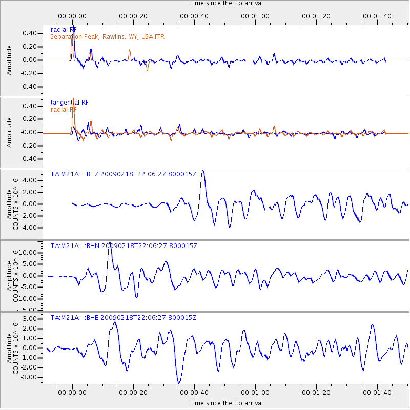
Signal To Noise
| Channel | StoN | STA | LTA |
| TA:M21A: :BHN:20090218T22:06:27.800015Z | 7.434327 | 1.4302643E-6 | 1.9238651E-7 |
| TA:M21A: :BHE:20090218T22:06:27.800015Z | 2.041042 | 3.6509283E-7 | 1.7887568E-7 |
| TA:M21A: :BHZ:20090218T22:06:27.800015Z | 3.276805 | 5.8719223E-7 | 1.7919658E-7 |
| Arrivals |
| Ps | 6.4 SECOND |
| PpPs | 26 SECOND |
| PsPs/PpSs | 33 SECOND |


