You are here: Home > Network List > CI - Caltech Regional Seismic Network Stations List
> Station MPM Manuel Prospect Mine, California, USA > Earthquake Result Viewer
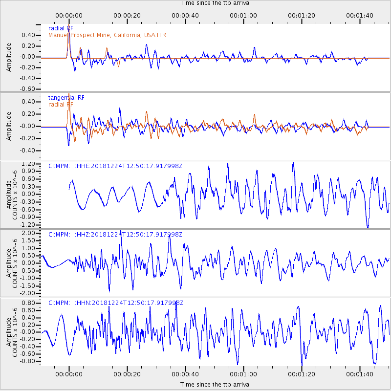
MPM Manuel Prospect Mine, California, USA - Earthquake Result Viewer
*The percent match for this event was below the threshold and hence no stack was calculated.
| Earthquake location: |
Komandorskiye Ostrova Region |
| Earthquake latitude/longitude: |
55.4/164.4 |
| Earthquake time(UTC): |
2018/12/24 (358) 12:41:19 GMT |
| Earthquake Depth: |
10 km |
| Earthquake Magnitude: |
6.1 Mww |
| Earthquake Catalog/Contributor: |
NEIC PDE/us |
|
| Network: |
CI Caltech Regional Seismic Network |
| Station: |
MPM Manuel Prospect Mine, California, USA |
| Lat/Lon: |
36.06 N/117.49 W |
| Elevation: |
185 m |
|
| Distance: |
54.8 deg |
| Az: |
76.073 deg |
| Baz: |
316.923 deg |
| Ray Param: |
$rayparam |
*The percent match for this event was below the threshold and hence was not used in the summary stack. |
|
| Radial Match: |
75.4867 % |
| Radial Bump: |
400 |
| Transverse Match: |
68.97781 % |
| Transverse Bump: |
400 |
| SOD ConfigId: |
13570011 |
| Insert Time: |
2019-05-02 04:26:15.028 +0000 |
| GWidth: |
2.5 |
| Max Bumps: |
400 |
| Tol: |
0.001 |
|
Signal To Noise
| Channel | StoN | STA | LTA |
| CI:MPM: :HHZ:20181224T12:50:17.917998Z | 0.72936755 | 2.393856E-7 | 3.282098E-7 |
| CI:MPM: :HHN:20181224T12:50:17.917998Z | 2.2416754 | 3.66309E-7 | 1.6340857E-7 |
| CI:MPM: :HHE:20181224T12:50:17.917998Z | 0.83757895 | 2.5786196E-7 | 3.0786586E-7 |
| Arrivals |
| Ps | |
| PpPs | |
| PsPs/PpSs | |


