You are here: Home > Network List > CN - Canadian National Seismograph Network Stations List
> Station INK INUVIK, NT > Earthquake Result Viewer
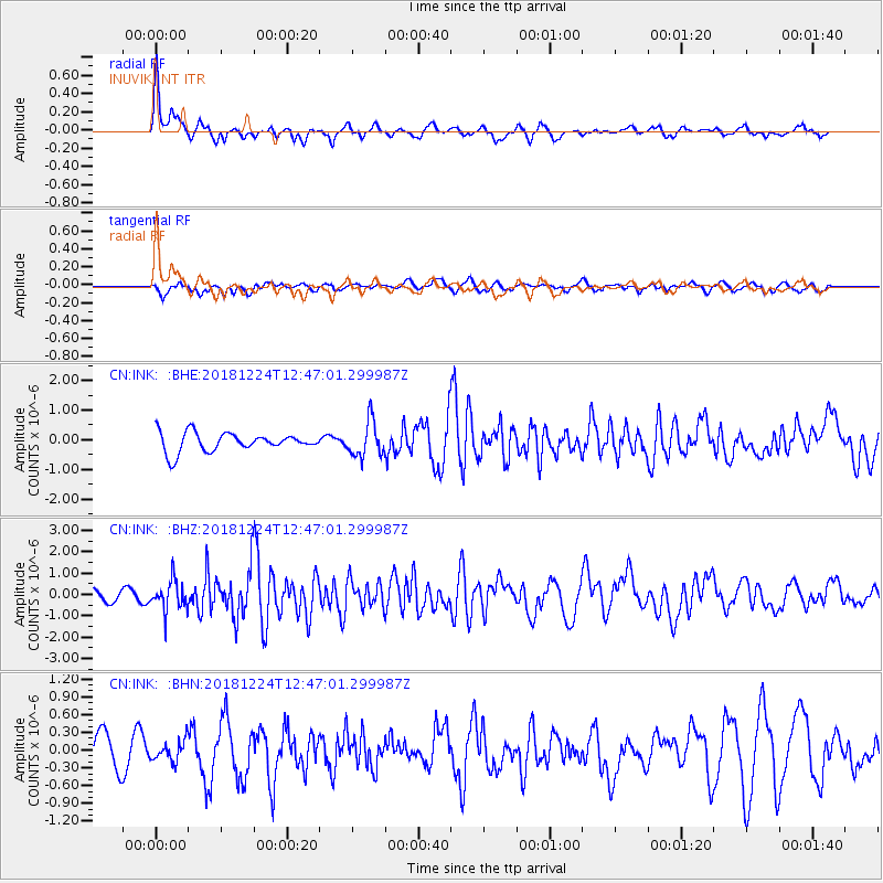
INK INUVIK, NT - Earthquake Result Viewer
*The percent match for this event was below the threshold and hence no stack was calculated.
| Earthquake location: |
Komandorskiye Ostrova Region |
| Earthquake latitude/longitude: |
55.4/164.4 |
| Earthquake time(UTC): |
2018/12/24 (358) 12:41:19 GMT |
| Earthquake Depth: |
10 km |
| Earthquake Magnitude: |
6.1 Mww |
| Earthquake Catalog/Contributor: |
NEIC PDE/us |
|
| Network: |
CN Canadian National Seismograph Network |
| Station: |
INK INUVIK, NT |
| Lat/Lon: |
68.31 N/133.53 W |
| Elevation: |
44 m |
|
| Distance: |
30.5 deg |
| Az: |
40.382 deg |
| Baz: |
276.486 deg |
| Ray Param: |
$rayparam |
*The percent match for this event was below the threshold and hence was not used in the summary stack. |
|
| Radial Match: |
74.35553 % |
| Radial Bump: |
382 |
| Transverse Match: |
45.25461 % |
| Transverse Bump: |
400 |
| SOD ConfigId: |
13570011 |
| Insert Time: |
2019-05-02 04:26:42.193 +0000 |
| GWidth: |
2.5 |
| Max Bumps: |
400 |
| Tol: |
0.001 |
|
Signal To Noise
| Channel | StoN | STA | LTA |
| CN:INK: :BHZ:20181224T12:47:01.299987Z | 1.523998 | 6.961057E-7 | 4.5676288E-7 |
| CN:INK: :BHN:20181224T12:47:01.299987Z | 0.57495993 | 1.7173214E-7 | 2.986854E-7 |
| CN:INK: :BHE:20181224T12:47:01.299987Z | 1.9032512 | 6.031647E-7 | 3.1691283E-7 |
| Arrivals |
| Ps | |
| PpPs | |
| PsPs/PpSs | |


