You are here: Home > Network List > TA - USArray Transportable Network (new EarthScope stations) Stations List
> Station M21A Separation Peak, Rawlins, WY, USA > Earthquake Result Viewer
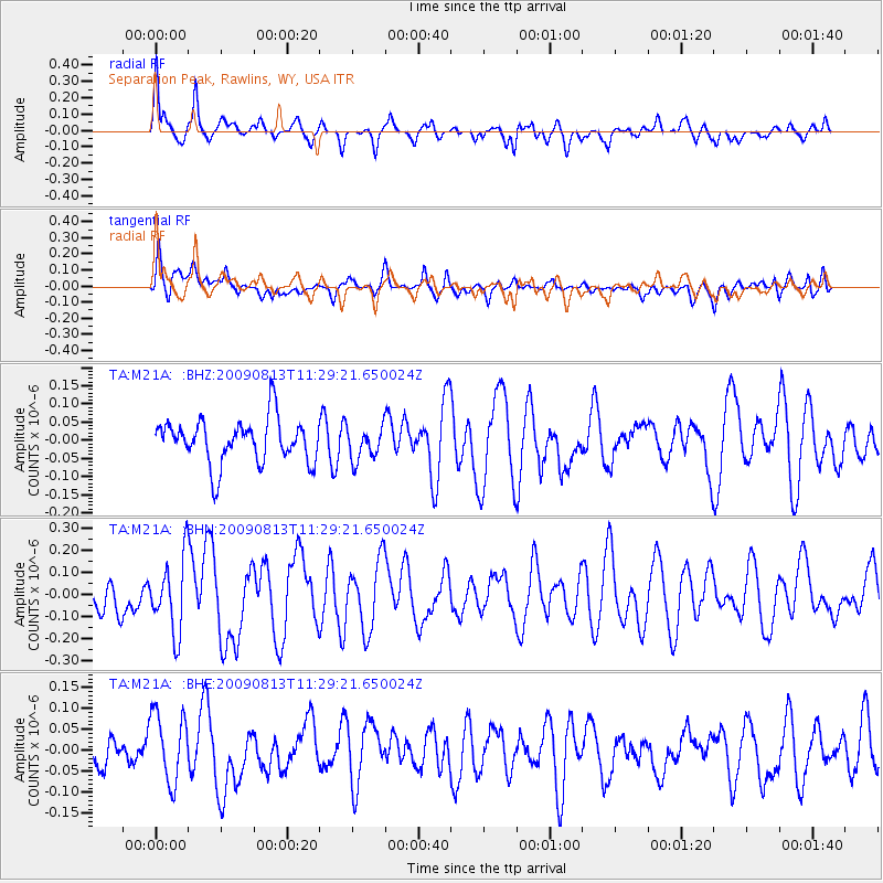
M21A Separation Peak, Rawlins, WY, USA - Earthquake Result Viewer
*The percent match for this event was below the threshold and hence no stack was calculated.
| Earthquake location: |
Tonga Islands |
| Earthquake latitude/longitude: |
-21.7/-174.6 |
| Earthquake time(UTC): |
2009/08/13 (225) 11:17:01 GMT |
| Earthquake Depth: |
10 km |
| Earthquake Magnitude: |
5.6 MW, 5.3 MB |
| Earthquake Catalog/Contributor: |
WHDF/NEIC |
|
| Network: |
TA USArray Transportable Network (new EarthScope stations) |
| Station: |
M21A Separation Peak, Rawlins, WY, USA |
| Lat/Lon: |
41.61 N/107.36 W |
| Elevation: |
2275 m |
|
| Distance: |
88.4 deg |
| Az: |
43.757 deg |
| Baz: |
239.079 deg |
| Ray Param: |
$rayparam |
*The percent match for this event was below the threshold and hence was not used in the summary stack. |
|
| Radial Match: |
72.51362 % |
| Radial Bump: |
400 |
| Transverse Match: |
58.00086 % |
| Transverse Bump: |
400 |
| SOD ConfigId: |
2622 |
| Insert Time: |
2010-03-06 18:56:26.629 +0000 |
| GWidth: |
2.5 |
| Max Bumps: |
400 |
| Tol: |
0.001 |
|
Signal To Noise
| Channel | StoN | STA | LTA |
| TA:M21A: :BHN:20090813T11:29:21.650024Z | 2.4614582 | 1.6668727E-7 | 6.7718915E-8 |
| TA:M21A: :BHE:20090813T11:29:21.650024Z | 1.6787058 | 8.260582E-8 | 4.920804E-8 |
| TA:M21A: :BHZ:20090813T11:29:21.650024Z | 0.73108804 | 4.447499E-8 | 6.0833976E-8 |
| Arrivals |
| Ps | |
| PpPs | |
| PsPs/PpSs | |


