You are here: Home > Network List > TJ - Tajikistan National Seismic Network Stations List
> Station GARM Garm, Tajikistan > Earthquake Result Viewer
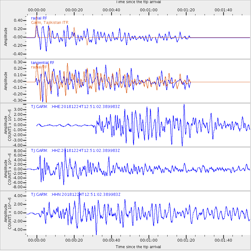
GARM Garm, Tajikistan - Earthquake Result Viewer
*The percent match for this event was below the threshold and hence no stack was calculated.
| Earthquake location: |
Komandorskiye Ostrova Region |
| Earthquake latitude/longitude: |
55.4/164.4 |
| Earthquake time(UTC): |
2018/12/24 (358) 12:41:19 GMT |
| Earthquake Depth: |
10 km |
| Earthquake Magnitude: |
6.1 Mww |
| Earthquake Catalog/Contributor: |
NEIC PDE/us |
|
| Network: |
TJ Tajikistan National Seismic Network |
| Station: |
GARM Garm, Tajikistan |
| Lat/Lon: |
39.00 N/70.32 E |
| Elevation: |
1305 m |
|
| Distance: |
61.1 deg |
| Az: |
297.429 deg |
| Baz: |
40.503 deg |
| Ray Param: |
$rayparam |
*The percent match for this event was below the threshold and hence was not used in the summary stack. |
|
| Radial Match: |
77.67342 % |
| Radial Bump: |
400 |
| Transverse Match: |
83.07761 % |
| Transverse Bump: |
400 |
| SOD ConfigId: |
13570011 |
| Insert Time: |
2019-05-02 04:31:31.568 +0000 |
| GWidth: |
2.5 |
| Max Bumps: |
400 |
| Tol: |
0.001 |
|
Signal To Noise
| Channel | StoN | STA | LTA |
| TJ:GARM: :HHZ:20181224T12:51:02.389983Z | 17.203543 | 2.6566383E-6 | 1.5442392E-7 |
| TJ:GARM: :HHN:20181224T12:51:02.389983Z | 5.7081676 | 6.818511E-7 | 1.1945183E-7 |
| TJ:GARM: :HHE:20181224T12:51:02.389983Z | 5.743738 | 6.7818917E-7 | 1.18074524E-7 |
| Arrivals |
| Ps | |
| PpPs | |
| PsPs/PpSs | |


