CALB Calabasas, California, USA - Earthquake Result Viewer
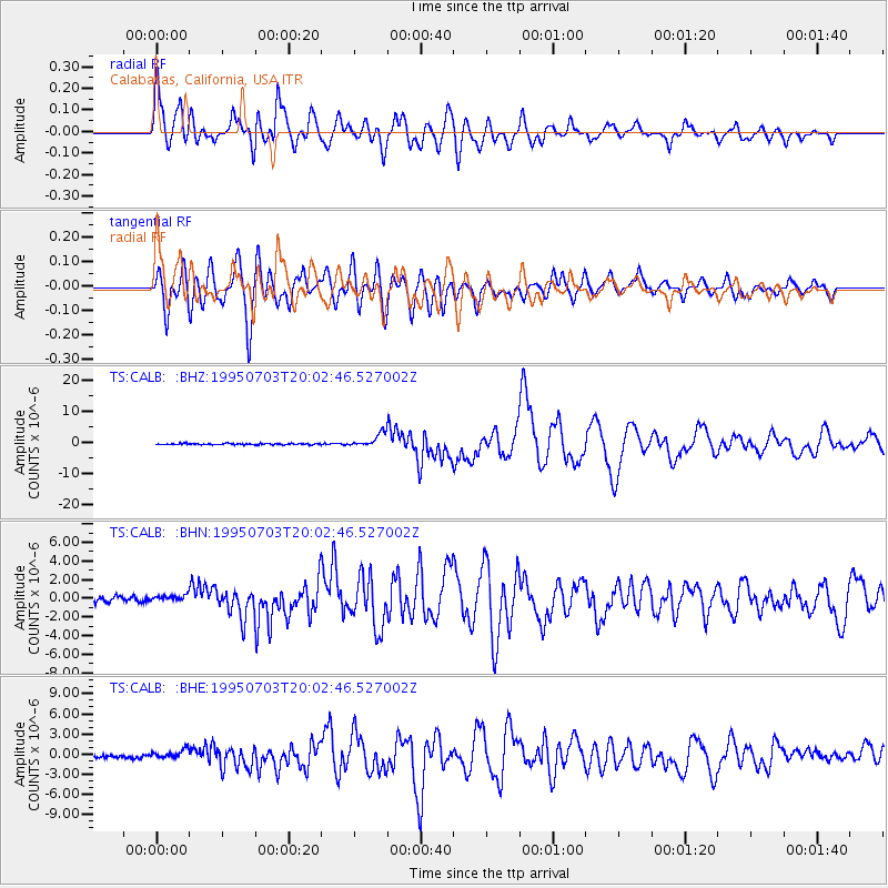
Earthquake location: Kermadec Islands, New Zealand
Earthquake latitude/longitude: -29.2/-177.6
Earthquake time(UTC): 1995/07/03 (184) 19:50:50 GMT
Earthquake Depth: 33 km
Earthquake Magnitude: 6.5 MB, 7.2 MS, 7.2 UNKNOWN, 7.2 MW
Earthquake Catalog/Contributor: WHDF/NEIC
Network: TS TERRAscope (Southern California Seismic Network)
Station: CALB Calabasas, California, USA
Lat/Lon: 34.14 N/118.63 W
Elevation: 0.0 m
Distance: 84.1 deg
Az: 45.608 deg
Baz: 228.877 deg
Ray Param: 0.045665685
Estimated Moho Depth: 27.0 km
Estimated Crust Vp/Vs: 1.69
Assumed Crust Vp: 6.1 km/s
Estimated Crust Vs: 3.62 km/s
Estimated Crust Poisson's Ratio: 0.23
Radial Match: 90.72895 %
Radial Bump: 400
Transverse Match: 81.59399 %
Transverse Bump: 400
SOD ConfigId: 6273
Insert Time: 2010-02-26 14:02:40.749 +0000
GWidth: 2.5
Max Bumps: 400
Tol: 0.001

Signal To Noise

ChannelStoNSTALTA
TS:CALB: :BHN:19950703T20:02:46.527002Z1.26928874.0945662E-73.2258745E-7
TS:CALB: :BHE:19950703T20:02:46.527002Z2.16196446.306341E-72.9169493E-7
TS:CALB: :BHZ:19950703T20:02:46.527002Z10.1040582.115477E-62.0936905E-7
Arrivals
Ps3.1 SECOND
PpPs12 SECOND
PsPs/PpSs15 SECOND