You are here: Home > Network List > TA - USArray Transportable Network (new EarthScope stations) Stations List
> Station C16K Lisburne Hills, AK, USA > Earthquake Result Viewer
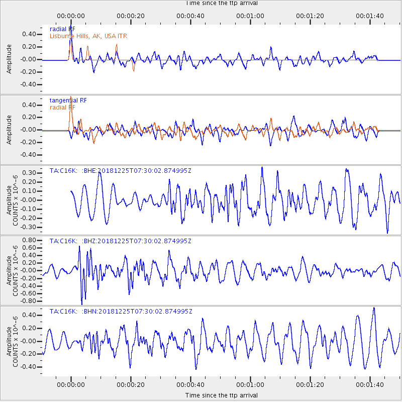
C16K Lisburne Hills, AK, USA - Earthquake Result Viewer
*The percent match for this event was below the threshold and hence no stack was calculated.
| Earthquake location: |
Northern Molucca Sea |
| Earthquake latitude/longitude: |
1.1/126.5 |
| Earthquake time(UTC): |
2018/12/25 (359) 07:18:19 GMT |
| Earthquake Depth: |
10 km |
| Earthquake Magnitude: |
5.2 Mww |
| Earthquake Catalog/Contributor: |
NEIC PDE/us |
|
| Network: |
TA USArray Transportable Network (new EarthScope stations) |
| Station: |
C16K Lisburne Hills, AK, USA |
| Lat/Lon: |
68.27 N/165.34 W |
| Elevation: |
102 m |
|
| Distance: |
81.0 deg |
| Az: |
20.486 deg |
| Baz: |
250.021 deg |
| Ray Param: |
$rayparam |
*The percent match for this event was below the threshold and hence was not used in the summary stack. |
|
| Radial Match: |
58.088326 % |
| Radial Bump: |
400 |
| Transverse Match: |
74.46952 % |
| Transverse Bump: |
400 |
| SOD ConfigId: |
13570011 |
| Insert Time: |
2019-05-02 04:44:21.943 +0000 |
| GWidth: |
2.5 |
| Max Bumps: |
400 |
| Tol: |
0.001 |
|
Signal To Noise
| Channel | StoN | STA | LTA |
| TA:C16K: :BHZ:20181225T07:30:02.874995Z | 4.1727214 | 3.3251453E-7 | 7.9687695E-8 |
| TA:C16K: :BHN:20181225T07:30:02.874995Z | 0.6083817 | 6.4926006E-8 | 1.0671919E-7 |
| TA:C16K: :BHE:20181225T07:30:02.874995Z | 0.6905524 | 8.8899455E-8 | 1.2873673E-7 |
| Arrivals |
| Ps | |
| PpPs | |
| PsPs/PpSs | |


