You are here: Home > Network List > TA - USArray Transportable Network (new EarthScope stations) Stations List
> Station O17K Koliganek, Bristol Bay, AK, USA > Earthquake Result Viewer
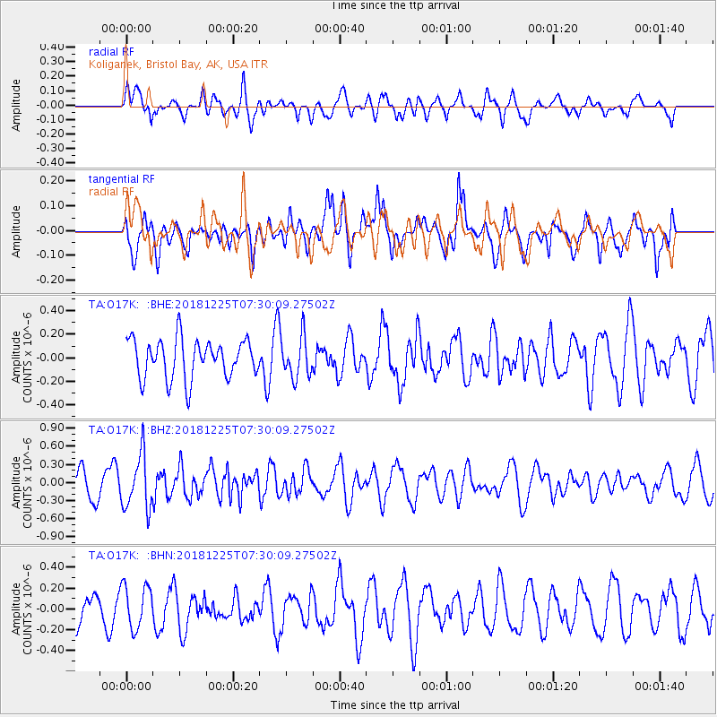
O17K Koliganek, Bristol Bay, AK, USA - Earthquake Result Viewer
*The percent match for this event was below the threshold and hence no stack was calculated.
| Earthquake location: |
Northern Molucca Sea |
| Earthquake latitude/longitude: |
1.1/126.5 |
| Earthquake time(UTC): |
2018/12/25 (359) 07:18:19 GMT |
| Earthquake Depth: |
10 km |
| Earthquake Magnitude: |
5.2 Mww |
| Earthquake Catalog/Contributor: |
NEIC PDE/us |
|
| Network: |
TA USArray Transportable Network (new EarthScope stations) |
| Station: |
O17K Koliganek, Bristol Bay, AK, USA |
| Lat/Lon: |
59.77 N/157.09 W |
| Elevation: |
156 m |
|
| Distance: |
82.2 deg |
| Az: |
29.764 deg |
| Baz: |
258.811 deg |
| Ray Param: |
$rayparam |
*The percent match for this event was below the threshold and hence was not used in the summary stack. |
|
| Radial Match: |
56.45762 % |
| Radial Bump: |
400 |
| Transverse Match: |
40.688038 % |
| Transverse Bump: |
400 |
| SOD ConfigId: |
13570011 |
| Insert Time: |
2019-05-02 04:45:11.135 +0000 |
| GWidth: |
2.5 |
| Max Bumps: |
400 |
| Tol: |
0.001 |
|
Signal To Noise
| Channel | StoN | STA | LTA |
| TA:O17K: :BHZ:20181225T07:30:09.27502Z | 1.9911889 | 4.5228222E-7 | 2.271418E-7 |
| TA:O17K: :BHN:20181225T07:30:09.27502Z | 1.3757014 | 2.092864E-7 | 1.521307E-7 |
| TA:O17K: :BHE:20181225T07:30:09.27502Z | 1.0409479 | 1.7198751E-7 | 1.6522202E-7 |
| Arrivals |
| Ps | |
| PpPs | |
| PsPs/PpSs | |


