You are here: Home > Network List > IU - Global Seismograph Network (GSN - IRIS/USGS) Stations List
> Station RSSD Black Hills, South Dakota, USA > Earthquake Result Viewer
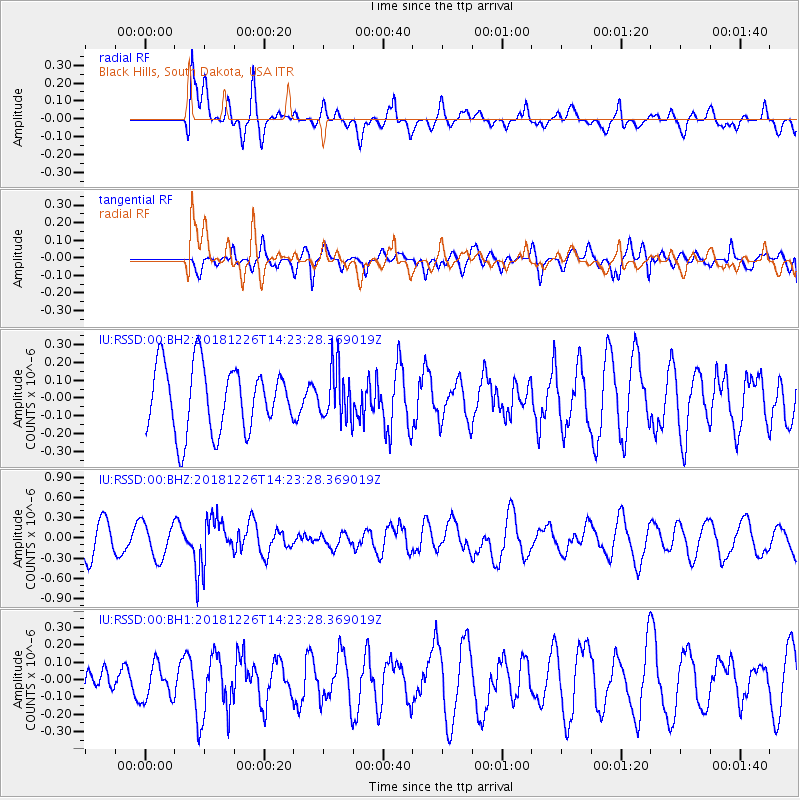
RSSD Black Hills, South Dakota, USA - Earthquake Result Viewer
*The percent match for this event was below the threshold and hence no stack was calculated.
| Earthquake location: |
Tonga Islands |
| Earthquake latitude/longitude: |
-17.2/-173.6 |
| Earthquake time(UTC): |
2018/12/26 (360) 14:11:21 GMT |
| Earthquake Depth: |
163 km |
| Earthquake Magnitude: |
6.0 Mi |
| Earthquake Catalog/Contributor: |
NEIC PDE/pt |
|
| Network: |
IU Global Seismograph Network (GSN - IRIS/USGS) |
| Station: |
RSSD Black Hills, South Dakota, USA |
| Lat/Lon: |
44.12 N/104.04 W |
| Elevation: |
2090 m |
|
| Distance: |
87.9 deg |
| Az: |
42.481 deg |
| Baz: |
243.7 deg |
| Ray Param: |
$rayparam |
*The percent match for this event was below the threshold and hence was not used in the summary stack. |
|
| Radial Match: |
44.83704 % |
| Radial Bump: |
400 |
| Transverse Match: |
52.74633 % |
| Transverse Bump: |
400 |
| SOD ConfigId: |
13570011 |
| Insert Time: |
2019-05-02 04:49:44.222 +0000 |
| GWidth: |
2.5 |
| Max Bumps: |
400 |
| Tol: |
0.001 |
|
Signal To Noise
| Channel | StoN | STA | LTA |
| IU:RSSD:00:BHZ:20181226T14:23:28.369019Z | 1.3891037 | 2.6097507E-7 | 1.87873E-7 |
| IU:RSSD:00:BH1:20181226T14:23:28.369019Z | 1.0908828 | 1.00576074E-7 | 9.2196956E-8 |
| IU:RSSD:00:BH2:20181226T14:23:28.369019Z | 0.41703185 | 8.803684E-8 | 2.111034E-7 |
| Arrivals |
| Ps | |
| PpPs | |
| PsPs/PpSs | |


