You are here: Home > Network List > IW - Intermountain West Stations List
> Station MOOW Moose Ponds, Wyoming, USA > Earthquake Result Viewer
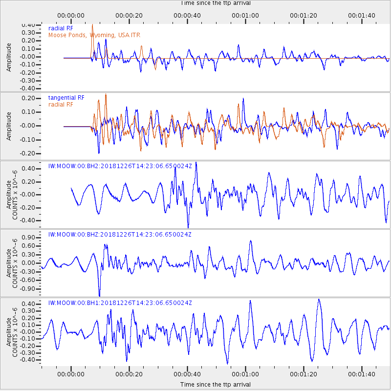
MOOW Moose Ponds, Wyoming, USA - Earthquake Result Viewer
*The percent match for this event was below the threshold and hence no stack was calculated.
| Earthquake location: |
Tonga Islands |
| Earthquake latitude/longitude: |
-17.2/-173.6 |
| Earthquake time(UTC): |
2018/12/26 (360) 14:11:21 GMT |
| Earthquake Depth: |
163 km |
| Earthquake Magnitude: |
6.0 Mi |
| Earthquake Catalog/Contributor: |
NEIC PDE/pt |
|
| Network: |
IW Intermountain West |
| Station: |
MOOW Moose Ponds, Wyoming, USA |
| Lat/Lon: |
43.75 N/110.74 W |
| Elevation: |
2128 m |
|
| Distance: |
83.5 deg |
| Az: |
40.475 deg |
| Baz: |
238.907 deg |
| Ray Param: |
$rayparam |
*The percent match for this event was below the threshold and hence was not used in the summary stack. |
|
| Radial Match: |
51.639717 % |
| Radial Bump: |
400 |
| Transverse Match: |
54.732178 % |
| Transverse Bump: |
400 |
| SOD ConfigId: |
13570011 |
| Insert Time: |
2019-05-02 04:49:48.339 +0000 |
| GWidth: |
2.5 |
| Max Bumps: |
400 |
| Tol: |
0.001 |
|
Signal To Noise
| Channel | StoN | STA | LTA |
| IW:MOOW:00:BHZ:20181226T14:23:06.650024Z | 1.01664 | 1.6192362E-7 | 1.5927333E-7 |
| IW:MOOW:00:BH1:20181226T14:23:06.650024Z | 0.18093844 | 2.947408E-8 | 1.6289562E-7 |
| IW:MOOW:00:BH2:20181226T14:23:06.650024Z | 0.40541458 | 4.9052602E-8 | 1.2099368E-7 |
| Arrivals |
| Ps | |
| PpPs | |
| PsPs/PpSs | |


