You are here: Home > Network List > TA - USArray Transportable Network (new EarthScope stations) Stations List
> Station 833A Chaparral WMA, Artesia Wells, TX, USA > Earthquake Result Viewer
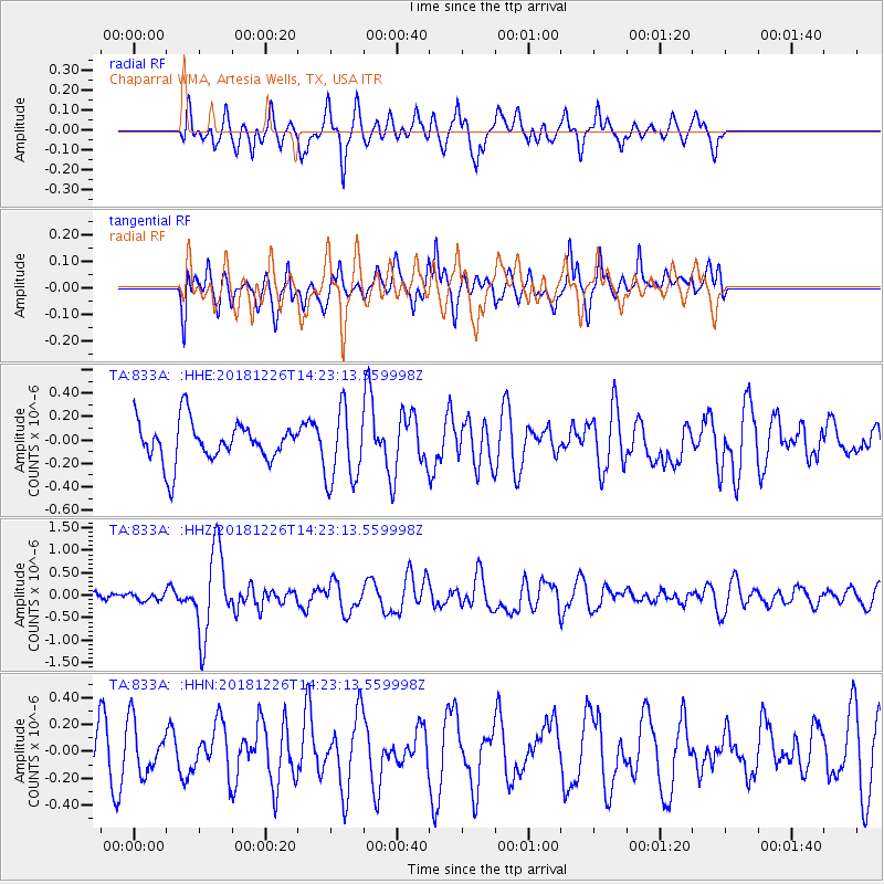
833A Chaparral WMA, Artesia Wells, TX, USA - Earthquake Result Viewer
*The percent match for this event was below the threshold and hence no stack was calculated.
| Earthquake location: |
Tonga Islands |
| Earthquake latitude/longitude: |
-17.2/-173.6 |
| Earthquake time(UTC): |
2018/12/26 (360) 14:11:21 GMT |
| Earthquake Depth: |
163 km |
| Earthquake Magnitude: |
6.0 Mi |
| Earthquake Catalog/Contributor: |
NEIC PDE/pt |
|
| Network: |
TA USArray Transportable Network (new EarthScope stations) |
| Station: |
833A Chaparral WMA, Artesia Wells, TX, USA |
| Lat/Lon: |
28.32 N/99.39 W |
| Elevation: |
171 m |
|
| Distance: |
84.8 deg |
| Az: |
58.415 deg |
| Baz: |
247.486 deg |
| Ray Param: |
$rayparam |
*The percent match for this event was below the threshold and hence was not used in the summary stack. |
|
| Radial Match: |
56.035652 % |
| Radial Bump: |
400 |
| Transverse Match: |
51.31503 % |
| Transverse Bump: |
400 |
| SOD ConfigId: |
13570011 |
| Insert Time: |
2019-05-02 04:52:09.466 +0000 |
| GWidth: |
2.5 |
| Max Bumps: |
400 |
| Tol: |
0.001 |
|
Signal To Noise
| Channel | StoN | STA | LTA |
| TA:833A: :HHZ:20181226T14:23:13.559998Z | 0.5240929 | 8.1870226E-8 | 1.5621319E-7 |
| TA:833A: :HHN:20181226T14:23:13.559998Z | 1.0529304 | 1.8732837E-7 | 1.7791146E-7 |
| TA:833A: :HHE:20181226T14:23:13.559998Z | 0.5464872 | 1.0830945E-7 | 1.981921E-7 |
| Arrivals |
| Ps | |
| PpPs | |
| PsPs/PpSs | |


