You are here: Home > Network List > UU - University of Utah Regional Network Stations List
> Station FORU South Mineral Mountains, UT, USA > Earthquake Result Viewer
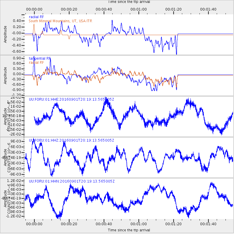
FORU South Mineral Mountains, UT, USA - Earthquake Result Viewer
*The percent match for this event was below the threshold and hence no stack was calculated.
| Earthquake location: |
Off E. Coast Of N. Island, N.Z. |
| Earthquake latitude/longitude: |
-37.6/179.1 |
| Earthquake time(UTC): |
2016/09/01 (245) 20:06:08 GMT |
| Earthquake Depth: |
14 km |
| Earthquake Magnitude: |
5.5 MB |
| Earthquake Catalog/Contributor: |
NEIC PDE/NEIC COMCAT |
|
| Network: |
UU University of Utah Regional Network |
| Station: |
FORU South Mineral Mountains, UT, USA |
| Lat/Lon: |
38.46 N/112.86 W |
| Elevation: |
1840 m |
|
| Distance: |
98.3 deg |
| Az: |
47.371 deg |
| Baz: |
228.074 deg |
| Ray Param: |
$rayparam |
*The percent match for this event was below the threshold and hence was not used in the summary stack. |
|
| Radial Match: |
67.84566 % |
| Radial Bump: |
400 |
| Transverse Match: |
57.52605 % |
| Transverse Bump: |
400 |
| SOD ConfigId: |
1634031 |
| Insert Time: |
2016-09-15 20:12:32.378 +0000 |
| GWidth: |
2.5 |
| Max Bumps: |
400 |
| Tol: |
0.001 |
|
Signal To Noise
| Channel | StoN | STA | LTA |
| UU:FORU:01:HHZ:20160901T20:19:13.565005Z | 2.0597136 | 7.643868E-9 | 3.7111312E-9 |
| UU:FORU:01:HHN:20160901T20:19:13.565005Z | 0.368551 | 2.3562226E-9 | 6.3932064E-9 |
| UU:FORU:01:HHE:20160901T20:19:13.565005Z | 1.625915 | 9.986402E-9 | 6.14202E-9 |
| Arrivals |
| Ps | |
| PpPs | |
| PsPs/PpSs | |


