You are here: Home > Network List > US - United States National Seismic Network Stations List
> Station DGMT Dagmar, Montana, USA > Earthquake Result Viewer
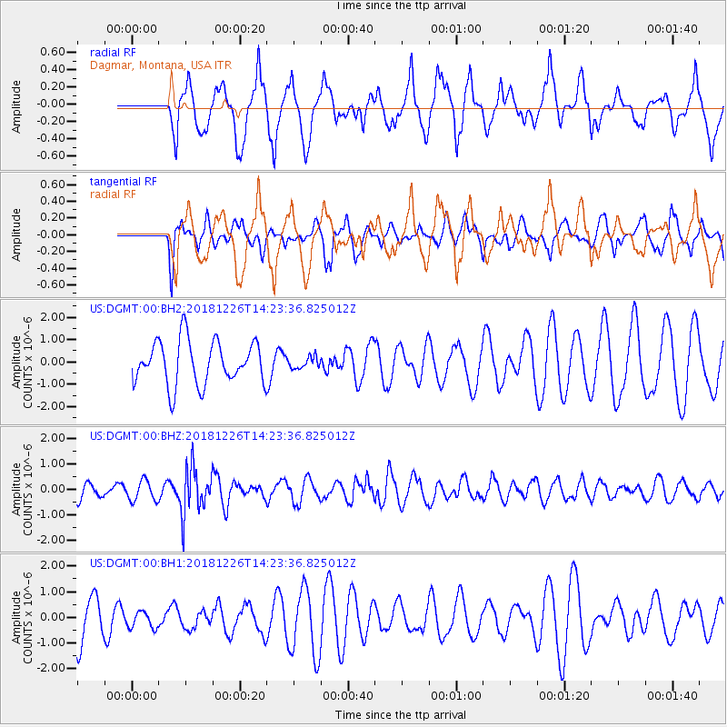
DGMT Dagmar, Montana, USA - Earthquake Result Viewer
*The percent match for this event was below the threshold and hence no stack was calculated.
| Earthquake location: |
Tonga Islands |
| Earthquake latitude/longitude: |
-17.2/-173.6 |
| Earthquake time(UTC): |
2018/12/26 (360) 14:11:21 GMT |
| Earthquake Depth: |
163 km |
| Earthquake Magnitude: |
6.0 Mi |
| Earthquake Catalog/Contributor: |
NEIC PDE/pt |
|
| Network: |
US United States National Seismic Network |
| Station: |
DGMT Dagmar, Montana, USA |
| Lat/Lon: |
48.47 N/104.20 W |
| Elevation: |
0.0 m |
|
| Distance: |
89.7 deg |
| Az: |
38.534 deg |
| Baz: |
243.503 deg |
| Ray Param: |
$rayparam |
*The percent match for this event was below the threshold and hence was not used in the summary stack. |
|
| Radial Match: |
42.984 % |
| Radial Bump: |
390 |
| Transverse Match: |
66.28488 % |
| Transverse Bump: |
400 |
| SOD ConfigId: |
13570011 |
| Insert Time: |
2019-05-02 04:54:13.784 +0000 |
| GWidth: |
2.5 |
| Max Bumps: |
400 |
| Tol: |
0.001 |
|
Signal To Noise
| Channel | StoN | STA | LTA |
| US:DGMT:00:BHZ:20181226T14:23:36.825012Z | 1.1976489 | 4.016694E-7 | 3.353816E-7 |
| US:DGMT:00:BH1:20181226T14:23:36.825012Z | 0.42084765 | 3.459984E-7 | 8.221464E-7 |
| US:DGMT:00:BH2:20181226T14:23:36.825012Z | 0.79515046 | 8.585018E-7 | 1.0796721E-6 |
| Arrivals |
| Ps | |
| PpPs | |
| PsPs/PpSs | |


