You are here: Home > Network List > TJ - Tajikistan National Seismic Network Stations List
> Station GARM Garm, Tajikistan > Earthquake Result Viewer
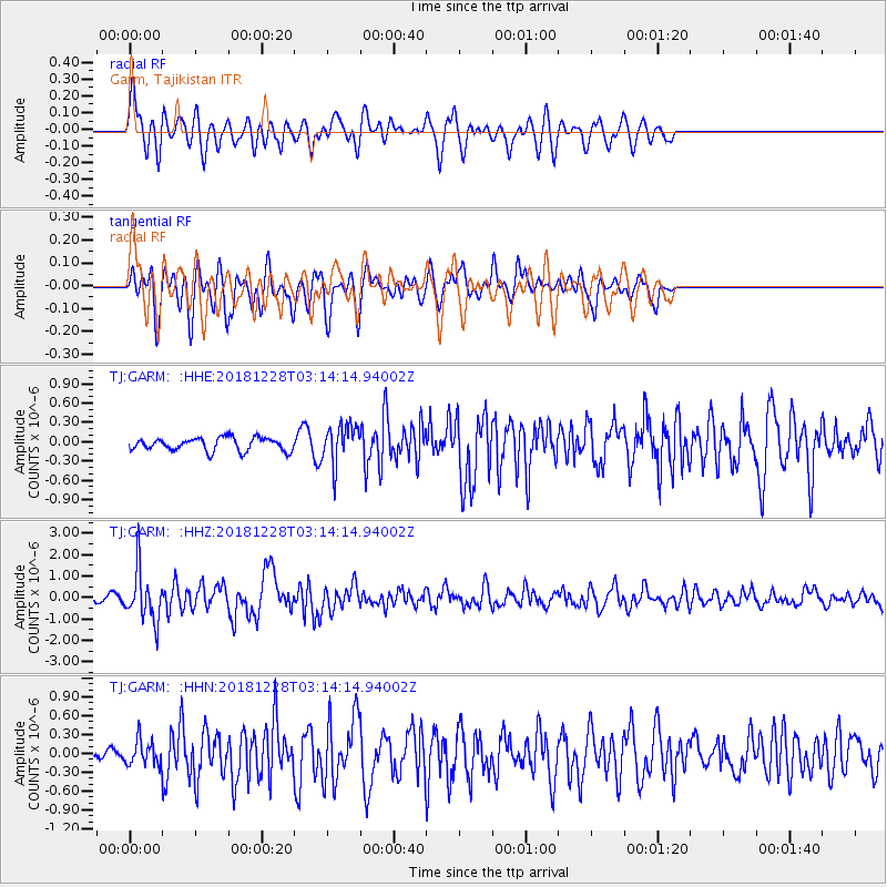
GARM Garm, Tajikistan - Earthquake Result Viewer
*The percent match for this event was below the threshold and hence no stack was calculated.
| Earthquake location: |
Irian Jaya Region, Indonesia |
| Earthquake latitude/longitude: |
-1.5/134.1 |
| Earthquake time(UTC): |
2018/12/28 (362) 03:03:34 GMT |
| Earthquake Depth: |
56 km |
| Earthquake Magnitude: |
5.8 Mww |
| Earthquake Catalog/Contributor: |
NEIC PDE/us |
|
| Network: |
TJ Tajikistan National Seismic Network |
| Station: |
GARM Garm, Tajikistan |
| Lat/Lon: |
39.00 N/70.32 E |
| Elevation: |
1305 m |
|
| Distance: |
70.8 deg |
| Az: |
312.284 deg |
| Baz: |
108.353 deg |
| Ray Param: |
$rayparam |
*The percent match for this event was below the threshold and hence was not used in the summary stack. |
|
| Radial Match: |
64.47516 % |
| Radial Bump: |
400 |
| Transverse Match: |
72.62721 % |
| Transverse Bump: |
400 |
| SOD ConfigId: |
13570011 |
| Insert Time: |
2019-05-02 04:59:50.083 +0000 |
| GWidth: |
2.5 |
| Max Bumps: |
400 |
| Tol: |
0.001 |
|
Signal To Noise
| Channel | StoN | STA | LTA |
| TJ:GARM: :HHZ:20181228T03:14:14.94002Z | 6.9339347 | 1.1809072E-6 | 1.703084E-7 |
| TJ:GARM: :HHN:20181228T03:14:14.94002Z | 2.0764961 | 1.9379341E-7 | 9.3327124E-8 |
| TJ:GARM: :HHE:20181228T03:14:14.94002Z | 3.0184648 | 3.0774248E-7 | 1.01953304E-7 |
| Arrivals |
| Ps | |
| PpPs | |
| PsPs/PpSs | |


