You are here: Home > Network List > AV - Alaska Volcano Observatory Stations List
> Station PLBL Mt. Peulik Volcano, Alaska > Earthquake Result Viewer
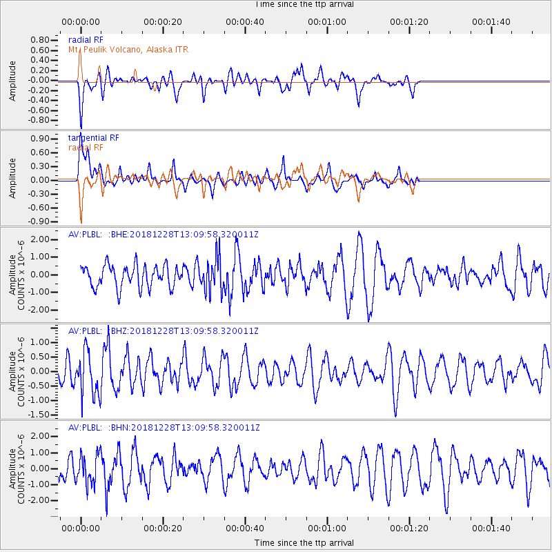
PLBL Mt. Peulik Volcano, Alaska - Earthquake Result Viewer
*The percent match for this event was below the threshold and hence no stack was calculated.
| Earthquake location: |
Kuril Islands |
| Earthquake latitude/longitude: |
44.2/148.6 |
| Earthquake time(UTC): |
2018/12/28 (362) 13:03:33 GMT |
| Earthquake Depth: |
49 km |
| Earthquake Magnitude: |
5.5 mb |
| Earthquake Catalog/Contributor: |
NEIC PDE/us |
|
| Network: |
AV Alaska Volcano Observatory |
| Station: |
PLBL Mt. Peulik Volcano, Alaska |
| Lat/Lon: |
57.70 N/156.82 W |
| Elevation: |
461 m |
|
| Distance: |
35.9 deg |
| Az: |
48.246 deg |
| Baz: |
272.101 deg |
| Ray Param: |
$rayparam |
*The percent match for this event was below the threshold and hence was not used in the summary stack. |
|
| Radial Match: |
61.404438 % |
| Radial Bump: |
400 |
| Transverse Match: |
62.772846 % |
| Transverse Bump: |
400 |
| SOD ConfigId: |
13570011 |
| Insert Time: |
2019-05-02 05:01:33.711 +0000 |
| GWidth: |
2.5 |
| Max Bumps: |
400 |
| Tol: |
0.001 |
|
Signal To Noise
| Channel | StoN | STA | LTA |
| AV:PLBL: :BHZ:20181228T13:09:58.320011Z | 2.1433709 | 7.5350124E-7 | 3.5154963E-7 |
| AV:PLBL: :BHN:20181228T13:09:58.320011Z | 1.4877856 | 8.9149995E-7 | 5.992126E-7 |
| AV:PLBL: :BHE:20181228T13:09:58.320011Z | 1.5773124 | 9.731742E-7 | 6.1698256E-7 |
| Arrivals |
| Ps | |
| PpPs | |
| PsPs/PpSs | |


