You are here: Home > Network List > AV - Alaska Volcano Observatory Stations List
> Station SPCR Ckakachatna River, Mount Spurr, Alaska > Earthquake Result Viewer
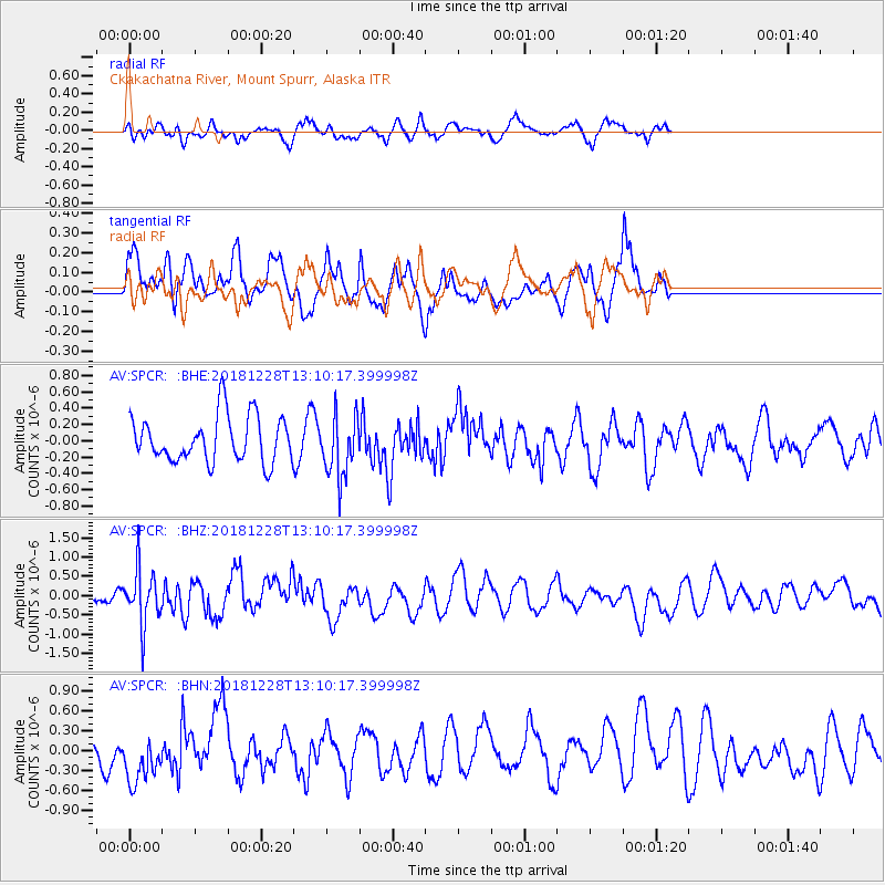
SPCR Ckakachatna River, Mount Spurr, Alaska - Earthquake Result Viewer
*The percent match for this event was below the threshold and hence no stack was calculated.
| Earthquake location: |
Kuril Islands |
| Earthquake latitude/longitude: |
44.2/148.6 |
| Earthquake time(UTC): |
2018/12/28 (362) 13:03:33 GMT |
| Earthquake Depth: |
49 km |
| Earthquake Magnitude: |
5.5 mb |
| Earthquake Catalog/Contributor: |
NEIC PDE/us |
|
| Network: |
AV Alaska Volcano Observatory |
| Station: |
SPCR Ckakachatna River, Mount Spurr, Alaska |
| Lat/Lon: |
61.20 N/152.21 W |
| Elevation: |
984 m |
|
| Distance: |
38.2 deg |
| Az: |
42.305 deg |
| Baz: |
271.323 deg |
| Ray Param: |
$rayparam |
*The percent match for this event was below the threshold and hence was not used in the summary stack. |
|
| Radial Match: |
47.371582 % |
| Radial Bump: |
400 |
| Transverse Match: |
62.372684 % |
| Transverse Bump: |
400 |
| SOD ConfigId: |
13570011 |
| Insert Time: |
2019-05-02 05:01:36.919 +0000 |
| GWidth: |
2.5 |
| Max Bumps: |
400 |
| Tol: |
0.001 |
|
Signal To Noise
| Channel | StoN | STA | LTA |
| AV:SPCR: :BHZ:20181228T13:10:17.399998Z | 4.005084 | 7.148479E-7 | 1.7848512E-7 |
| AV:SPCR: :BHN:20181228T13:10:17.399998Z | 0.9377947 | 3.719585E-7 | 3.9663107E-7 |
| AV:SPCR: :BHE:20181228T13:10:17.399998Z | 1.3579798 | 3.8112714E-7 | 2.8065745E-7 |
| Arrivals |
| Ps | |
| PpPs | |
| PsPs/PpSs | |


