You are here: Home > Network List > TA - USArray Transportable Network (new EarthScope stations) Stations List
> Station A21K Barrow, AK, USA > Earthquake Result Viewer
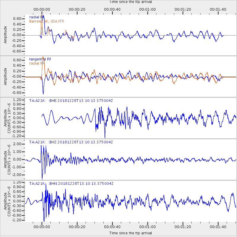
A21K Barrow, AK, USA - Earthquake Result Viewer
*The percent match for this event was below the threshold and hence no stack was calculated.
| Earthquake location: |
Kuril Islands |
| Earthquake latitude/longitude: |
44.2/148.6 |
| Earthquake time(UTC): |
2018/12/28 (362) 13:03:33 GMT |
| Earthquake Depth: |
49 km |
| Earthquake Magnitude: |
5.5 mb |
| Earthquake Catalog/Contributor: |
NEIC PDE/us |
|
| Network: |
TA USArray Transportable Network (new EarthScope stations) |
| Station: |
A21K Barrow, AK, USA |
| Lat/Lon: |
71.32 N/156.62 W |
| Elevation: |
577 m |
|
| Distance: |
37.7 deg |
| Az: |
25.503 deg |
| Baz: |
253.988 deg |
| Ray Param: |
$rayparam |
*The percent match for this event was below the threshold and hence was not used in the summary stack. |
|
| Radial Match: |
60.731632 % |
| Radial Bump: |
400 |
| Transverse Match: |
64.197174 % |
| Transverse Bump: |
400 |
| SOD ConfigId: |
13570011 |
| Insert Time: |
2019-05-02 05:07:22.855 +0000 |
| GWidth: |
2.5 |
| Max Bumps: |
400 |
| Tol: |
0.001 |
|
Signal To Noise
| Channel | StoN | STA | LTA |
| TA:A21K: :BHZ:20181228T13:10:13.375004Z | 7.8623266 | 1.085173E-6 | 1.3802187E-7 |
| TA:A21K: :BHN:20181228T13:10:13.375004Z | 4.4793997 | 5.1915106E-7 | 1.1589746E-7 |
| TA:A21K: :BHE:20181228T13:10:13.375004Z | 2.2429063 | 4.4708415E-7 | 1.993325E-7 |
| Arrivals |
| Ps | |
| PpPs | |
| PsPs/PpSs | |


