You are here: Home > Network List > TA - USArray Transportable Network (new EarthScope stations) Stations List
> Station F20K Avaraart Lake, AK, USA > Earthquake Result Viewer
F20K Avaraart Lake, AK, USA - Earthquake Result Viewer
*The percent match for this event was below the threshold and hence no stack was calculated.
| Earthquake location: |
Kuril Islands |
| Earthquake latitude/longitude: |
44.2/148.6 |
| Earthquake time(UTC): |
2018/12/28 (362) 13:03:33 GMT |
| Earthquake Depth: |
49 km |
| Earthquake Magnitude: |
5.5 mb |
| Earthquake Catalog/Contributor: |
NEIC PDE/us |
|
| Network: |
TA USArray Transportable Network (new EarthScope stations) |
| Station: |
F20K Avaraart Lake, AK, USA |
| Lat/Lon: |
67.05 N/155.73 W |
| Elevation: |
136 m |
|
| Distance: |
37.1 deg |
| Az: |
32.522 deg |
| Baz: |
260.402 deg |
| Ray Param: |
$rayparam |
*The percent match for this event was below the threshold and hence was not used in the summary stack. |
|
| Radial Match: |
64.16156 % |
| Radial Bump: |
400 |
| Transverse Match: |
54.396664 % |
| Transverse Bump: |
400 |
| SOD ConfigId: |
13570011 |
| Insert Time: |
2019-05-02 05:07:52.669 +0000 |
| GWidth: |
2.5 |
| Max Bumps: |
400 |
| Tol: |
0.001 |
|
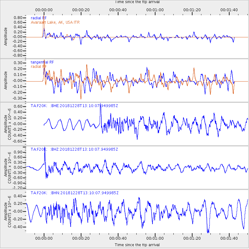
Signal To Noise
| Channel | StoN | STA | LTA |
| TA:F20K: :BHZ:20181228T13:10:07.949985Z | 3.5224974 | 3.6122563E-7 | 1.02548164E-7 |
| TA:F20K: :BHN:20181228T13:10:07.949985Z | 0.97929674 | 1.23123E-7 | 1.2572593E-7 |
| TA:F20K: :BHE:20181228T13:10:07.949985Z | 1.8981953 | 2.329829E-7 | 1.2273917E-7 |
| Arrivals |
| Ps | |
| PpPs | |
| PsPs/PpSs | |


