You are here: Home > Network List > TA - USArray Transportable Network (new EarthScope stations) Stations List
> Station H31M Peel River, Yukon, CAN > Earthquake Result Viewer
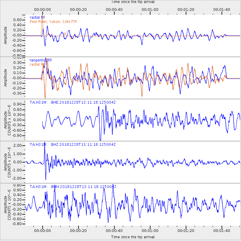
H31M Peel River, Yukon, CAN - Earthquake Result Viewer
*The percent match for this event was below the threshold and hence no stack was calculated.
| Earthquake location: |
Kuril Islands |
| Earthquake latitude/longitude: |
44.2/148.6 |
| Earthquake time(UTC): |
2018/12/28 (362) 13:03:33 GMT |
| Earthquake Depth: |
49 km |
| Earthquake Magnitude: |
5.5 mb |
| Earthquake Catalog/Contributor: |
NEIC PDE/us |
|
| Network: |
TA USArray Transportable Network (new EarthScope stations) |
| Station: |
H31M Peel River, Yukon, CAN |
| Lat/Lon: |
65.81 N/134.34 W |
| Elevation: |
642 m |
|
| Distance: |
45.6 deg |
| Az: |
34.191 deg |
| Baz: |
281.274 deg |
| Ray Param: |
$rayparam |
*The percent match for this event was below the threshold and hence was not used in the summary stack. |
|
| Radial Match: |
54.074005 % |
| Radial Bump: |
400 |
| Transverse Match: |
63.11905 % |
| Transverse Bump: |
400 |
| SOD ConfigId: |
13570011 |
| Insert Time: |
2019-05-02 05:08:16.158 +0000 |
| GWidth: |
2.5 |
| Max Bumps: |
400 |
| Tol: |
0.001 |
|
Signal To Noise
| Channel | StoN | STA | LTA |
| TA:H31M: :BHZ:20181228T13:11:18.125004Z | 4.022507 | 8.182347E-7 | 2.034141E-7 |
| TA:H31M: :BHN:20181228T13:11:18.125004Z | 1.3551543 | 2.8574527E-7 | 2.108581E-7 |
| TA:H31M: :BHE:20181228T13:11:18.125004Z | 2.2948437 | 5.781711E-7 | 2.519436E-7 |
| Arrivals |
| Ps | |
| PpPs | |
| PsPs/PpSs | |


