G15A Dillon, MT, USA - Earthquake Result Viewer
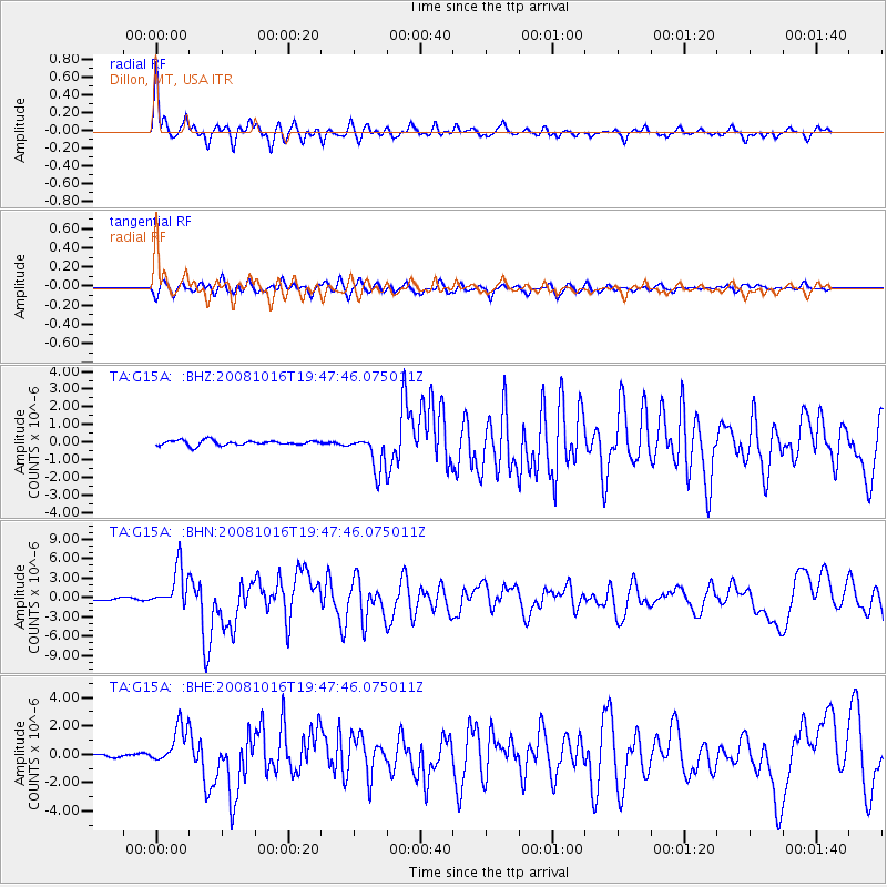
Earthquake location: Near Coast Of Chiapas, Mexico
Earthquake latitude/longitude: 14.4/-92.4
Earthquake time(UTC): 2008/10/16 (290) 19:41:25 GMT
Earthquake Depth: 24 km
Earthquake Magnitude: 6.1 MB, 6.6 MS, 6.7 MW, 6.6 MW
Earthquake Catalog/Contributor: WHDF/NEIC
Network: TA USArray Transportable Network (new EarthScope stations)
Station: G15A Dillon, MT, USA
Lat/Lon: 45.17 N/112.49 W
Elevation: 1857 m
Distance: 35.1 deg
Az: 334.933 deg
Baz: 144.531 deg
Ray Param: 0.07738362
Estimated Moho Depth: 32.0 km
Estimated Crust Vp/Vs: 1.86
Assumed Crust Vp: 6.577 km/s
Estimated Crust Vs: 3.531 km/s
Estimated Crust Poisson's Ratio: 0.30
Radial Match: 82.00457 %
Radial Bump: 400
Transverse Match: 78.118195 %
Transverse Bump: 400
SOD ConfigId: 2556
Insert Time: 2010-03-06 19:01:44.166 +0000
GWidth: 2.5
Max Bumps: 400
Tol: 0.001

Signal To Noise

ChannelStoNSTALTA
TA:G15A: :BHN:20081016T19:47:46.075011Z16.2385853.1316051E-61.9284965E-7
TA:G15A: :BHE:20081016T19:47:46.075011Z6.67322641.3463057E-62.0174734E-7
TA:G15A: :BHZ:20081016T19:47:46.075011Z7.253011.024712E-61.4128092E-7
Arrivals
Ps4.5 SECOND
PpPs13 SECOND
PsPs/PpSs17 SECOND