You are here: Home > Network List > US - United States National Seismic Network Stations List
> Station MSO Missoula, Montana, USA > Earthquake Result Viewer
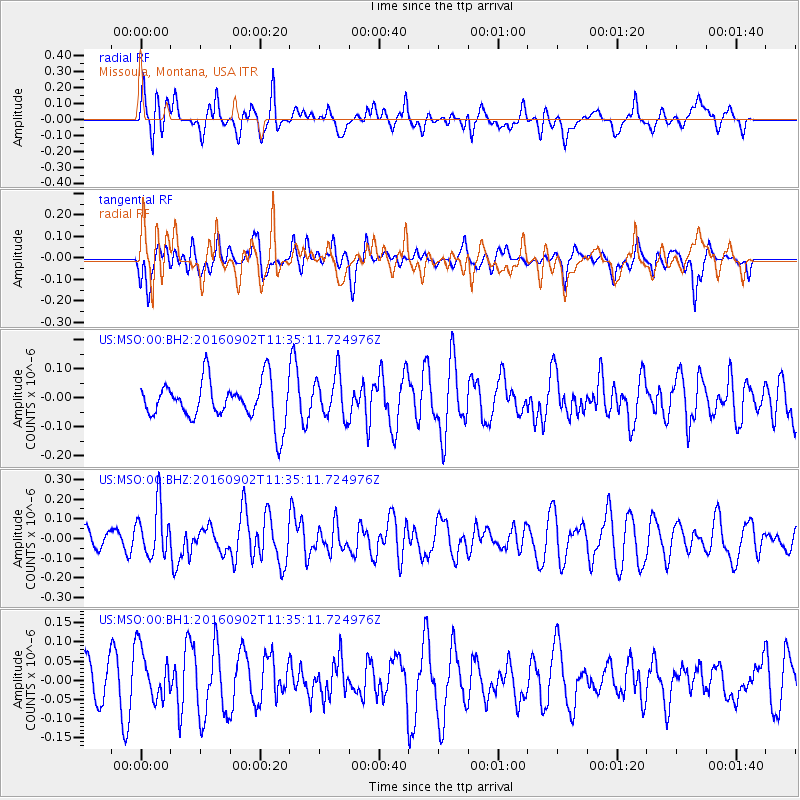
MSO Missoula, Montana, USA - Earthquake Result Viewer
*The percent match for this event was below the threshold and hence no stack was calculated.
| Earthquake location: |
Tonga Islands |
| Earthquake latitude/longitude: |
-19.6/-173.6 |
| Earthquake time(UTC): |
2016/09/02 (246) 11:23:07 GMT |
| Earthquake Depth: |
10 km |
| Earthquake Magnitude: |
5.5 MB |
| Earthquake Catalog/Contributor: |
NEIC PDE/NEIC ALERT |
|
| Network: |
US United States National Seismic Network |
| Station: |
MSO Missoula, Montana, USA |
| Lat/Lon: |
46.83 N/113.94 W |
| Elevation: |
1264 m |
|
| Distance: |
85.1 deg |
| Az: |
36.498 deg |
| Baz: |
234.761 deg |
| Ray Param: |
$rayparam |
*The percent match for this event was below the threshold and hence was not used in the summary stack. |
|
| Radial Match: |
66.64137 % |
| Radial Bump: |
400 |
| Transverse Match: |
38.520153 % |
| Transverse Bump: |
389 |
| SOD ConfigId: |
1634031 |
| Insert Time: |
2016-09-16 11:29:19.500 +0000 |
| GWidth: |
2.5 |
| Max Bumps: |
400 |
| Tol: |
0.001 |
|
Signal To Noise
| Channel | StoN | STA | LTA |
| US:MSO:00:BHZ:20160902T11:35:11.724976Z | 2.2079833 | 1.286799E-7 | 5.827938E-8 |
| US:MSO:00:BH1:20160902T11:35:11.724976Z | 1.5018467 | 6.72797E-8 | 4.4797982E-8 |
| US:MSO:00:BH2:20160902T11:35:11.724976Z | 1.1022455 | 7.5894235E-8 | 6.8854206E-8 |
| Arrivals |
| Ps | |
| PpPs | |
| PsPs/PpSs | |


