You are here: Home > Network List > TA - USArray Transportable Network (new EarthScope stations) Stations List
> Station G21K Allakaket, AK, USA > Earthquake Result Viewer
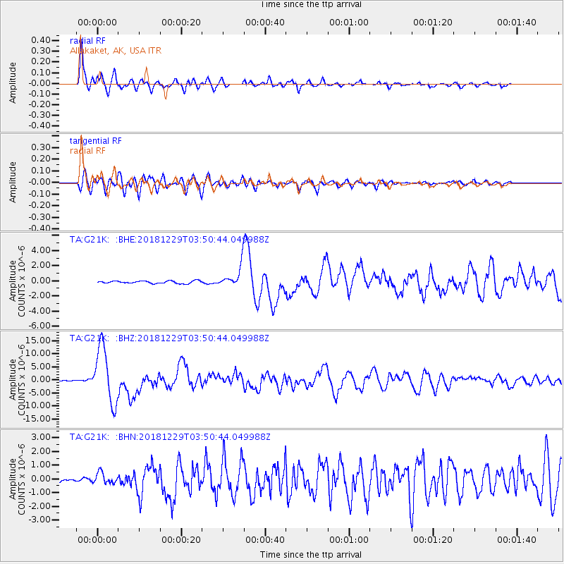
G21K Allakaket, AK, USA - Earthquake Result Viewer
*The percent match for this event was below the threshold and hence no stack was calculated.
| Earthquake location: |
Mindanao, Philippines |
| Earthquake latitude/longitude: |
5.8/126.9 |
| Earthquake time(UTC): |
2018/12/29 (363) 03:39:12 GMT |
| Earthquake Depth: |
49 km |
| Earthquake Magnitude: |
7.2 Mi |
| Earthquake Catalog/Contributor: |
NEIC PDE/at |
|
| Network: |
TA USArray Transportable Network (new EarthScope stations) |
| Station: |
G21K Allakaket, AK, USA |
| Lat/Lon: |
66.52 N/153.51 W |
| Elevation: |
446 m |
|
| Distance: |
80.6 deg |
| Az: |
23.552 deg |
| Baz: |
262.754 deg |
| Ray Param: |
$rayparam |
*The percent match for this event was below the threshold and hence was not used in the summary stack. |
|
| Radial Match: |
94.82973 % |
| Radial Bump: |
400 |
| Transverse Match: |
84.776375 % |
| Transverse Bump: |
400 |
| SOD ConfigId: |
13570011 |
| Insert Time: |
2019-05-02 05:16:16.176 +0000 |
| GWidth: |
2.5 |
| Max Bumps: |
400 |
| Tol: |
0.001 |
|
Signal To Noise
| Channel | StoN | STA | LTA |
| TA:G21K: :BHZ:20181229T03:50:44.049988Z | 74.50695 | 1.09366265E-5 | 1.4678666E-7 |
| TA:G21K: :BHN:20181229T03:50:44.049988Z | 1.9238435 | 4.0026438E-7 | 2.0805454E-7 |
| TA:G21K: :BHE:20181229T03:50:44.049988Z | 20.774776 | 3.6051579E-6 | 1.7353533E-7 |
| Arrivals |
| Ps | |
| PpPs | |
| PsPs/PpSs | |


