You are here: Home > Network List > TA - USArray Transportable Network (new EarthScope stations) Stations List
> Station G31M Satah River, YT, CAN > Earthquake Result Viewer
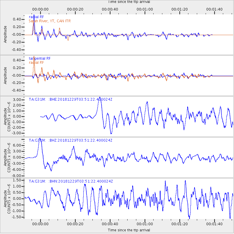
G31M Satah River, YT, CAN - Earthquake Result Viewer
*The percent match for this event was below the threshold and hence no stack was calculated.
| Earthquake location: |
Mindanao, Philippines |
| Earthquake latitude/longitude: |
5.8/126.9 |
| Earthquake time(UTC): |
2018/12/29 (363) 03:39:12 GMT |
| Earthquake Depth: |
49 km |
| Earthquake Magnitude: |
7.2 Mi |
| Earthquake Catalog/Contributor: |
NEIC PDE/at |
|
| Network: |
TA USArray Transportable Network (new EarthScope stations) |
| Station: |
G31M Satah River, YT, CAN |
| Lat/Lon: |
66.92 N/134.27 W |
| Elevation: |
61 m |
|
| Distance: |
88.2 deg |
| Az: |
22.938 deg |
| Baz: |
280.371 deg |
| Ray Param: |
$rayparam |
*The percent match for this event was below the threshold and hence was not used in the summary stack. |
|
| Radial Match: |
93.08341 % |
| Radial Bump: |
400 |
| Transverse Match: |
68.45928 % |
| Transverse Bump: |
400 |
| SOD ConfigId: |
13570011 |
| Insert Time: |
2019-05-02 05:16:20.850 +0000 |
| GWidth: |
2.5 |
| Max Bumps: |
400 |
| Tol: |
0.001 |
|
Signal To Noise
| Channel | StoN | STA | LTA |
| TA:G31M: :BHZ:20181229T03:51:22.400024Z | 29.783354 | 5.5437267E-6 | 1.8613508E-7 |
| TA:G31M: :BHN:20181229T03:51:22.400024Z | 2.5325406 | 4.941599E-7 | 1.9512417E-7 |
| TA:G31M: :BHE:20181229T03:51:22.400024Z | 7.185416 | 2.1078422E-6 | 2.9335007E-7 |
| Arrivals |
| Ps | |
| PpPs | |
| PsPs/PpSs | |


