You are here: Home > Network List > TS - TERRAscope (Southern California Seismic Network) Stations List
> Station CALB Calabasas, California, USA > Earthquake Result Viewer
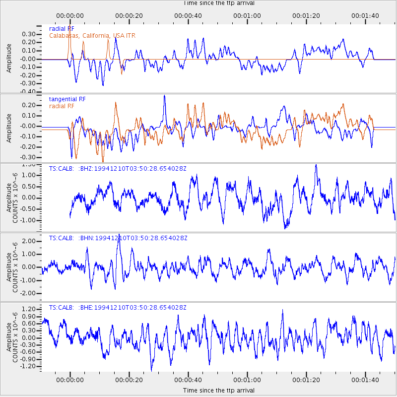
CALB Calabasas, California, USA - Earthquake Result Viewer
*The percent match for this event was below the threshold and hence no stack was calculated.
| Earthquake location: |
Near Coast Of Northern Chile |
| Earthquake latitude/longitude: |
-23.6/-70.5 |
| Earthquake time(UTC): |
1994/12/10 (344) 03:39:31 GMT |
| Earthquake Depth: |
37 km |
| Earthquake Magnitude: |
5.7 MB, 5.6 MS, 5.3 UNKNOWN, 6.2 MW |
| Earthquake Catalog/Contributor: |
WHDF/NEIC |
|
| Network: |
TS TERRAscope (Southern California Seismic Network) |
| Station: |
CALB Calabasas, California, USA |
| Lat/Lon: |
34.14 N/118.63 W |
| Elevation: |
0.0 m |
|
| Distance: |
73.4 deg |
| Az: |
319.889 deg |
| Baz: |
134.545 deg |
| Ray Param: |
$rayparam |
*The percent match for this event was below the threshold and hence was not used in the summary stack. |
|
| Radial Match: |
64.18193 % |
| Radial Bump: |
400 |
| Transverse Match: |
60.105736 % |
| Transverse Bump: |
400 |
| SOD ConfigId: |
4480 |
| Insert Time: |
2010-02-26 14:03:05.179 +0000 |
| GWidth: |
2.5 |
| Max Bumps: |
400 |
| Tol: |
0.001 |
|
Signal To Noise
| Channel | StoN | STA | LTA |
| TS:CALB: :BHN:19941210T03:50:28.654028Z | 0.9325085 | 2.8498488E-7 | 3.05611E-7 |
| TS:CALB: :BHE:19941210T03:50:28.654028Z | 0.56788576 | 1.8013881E-7 | 3.172096E-7 |
| TS:CALB: :BHZ:19941210T03:50:28.654028Z | 1.1523294 | 3.7096044E-7 | 3.2192222E-7 |
| Arrivals |
| Ps | |
| PpPs | |
| PsPs/PpSs | |


