You are here: Home > Network List > TA - USArray Transportable Network (new EarthScope stations) Stations List
> Station G15A Dillon, MT, USA > Earthquake Result Viewer
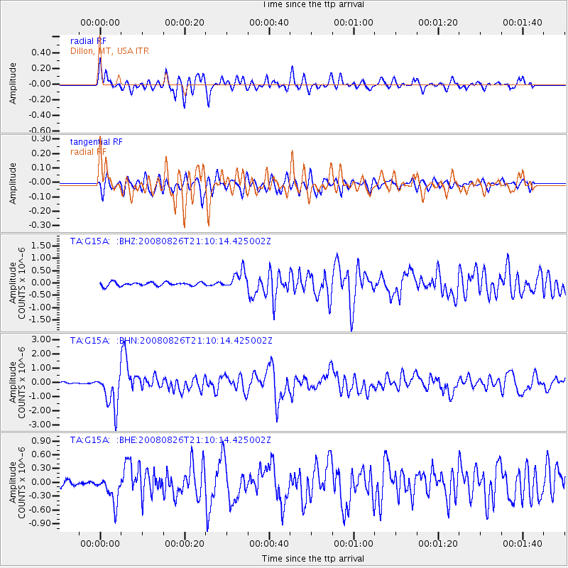
G15A Dillon, MT, USA - Earthquake Result Viewer
*The percent match for this event was below the threshold and hence no stack was calculated.
| Earthquake location: |
Peru-Brazil Border Region |
| Earthquake latitude/longitude: |
-7.6/-74.4 |
| Earthquake time(UTC): |
2008/08/26 (239) 21:00:36 GMT |
| Earthquake Depth: |
154 km |
| Earthquake Magnitude: |
6.0 MB, 6.4 MW, 6.4 MW |
| Earthquake Catalog/Contributor: |
WHDF/NEIC |
|
| Network: |
TA USArray Transportable Network (new EarthScope stations) |
| Station: |
G15A Dillon, MT, USA |
| Lat/Lon: |
45.17 N/112.49 W |
| Elevation: |
1857 m |
|
| Distance: |
62.7 deg |
| Az: |
330.576 deg |
| Baz: |
136.499 deg |
| Ray Param: |
$rayparam |
*The percent match for this event was below the threshold and hence was not used in the summary stack. |
|
| Radial Match: |
71.41989 % |
| Radial Bump: |
400 |
| Transverse Match: |
63.105305 % |
| Transverse Bump: |
400 |
| SOD ConfigId: |
2504 |
| Insert Time: |
2010-03-06 19:04:26.514 +0000 |
| GWidth: |
2.5 |
| Max Bumps: |
400 |
| Tol: |
0.001 |
|
Signal To Noise
| Channel | StoN | STA | LTA |
| TA:G15A: :BHN:20080826T21:10:14.425002Z | 23.134005 | 1.2745044E-6 | 5.509225E-8 |
| TA:G15A: :BHE:20080826T21:10:14.425002Z | 4.2108755 | 3.0497583E-7 | 7.242575E-8 |
| TA:G15A: :BHZ:20080826T21:10:14.425002Z | 5.238435 | 3.7728879E-7 | 7.202319E-8 |
| Arrivals |
| Ps | |
| PpPs | |
| PsPs/PpSs | |


