You are here: Home > Network List > TA - USArray Transportable Network (new EarthScope stations) Stations List
> Station R33M Jennings River, BC, CAN > Earthquake Result Viewer
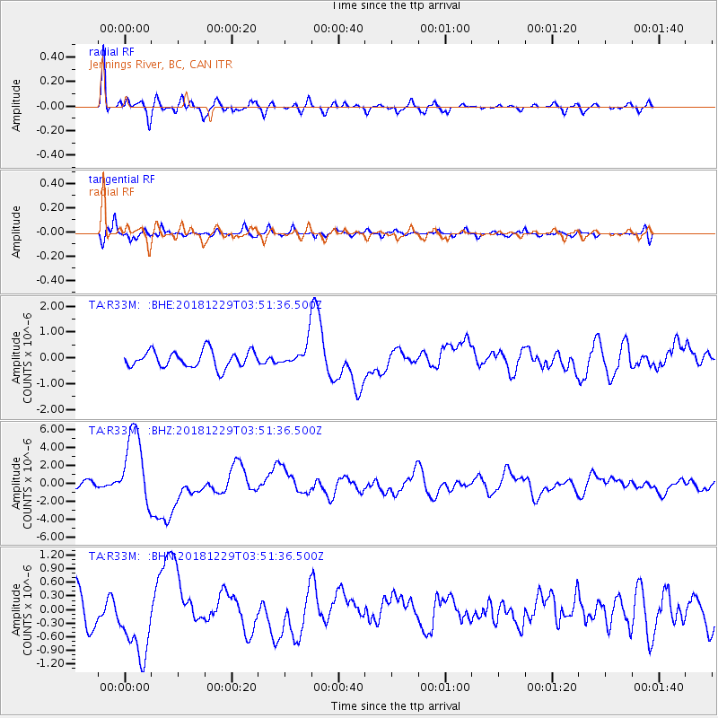
R33M Jennings River, BC, CAN - Earthquake Result Viewer
*The percent match for this event was below the threshold and hence no stack was calculated.
| Earthquake location: |
Mindanao, Philippines |
| Earthquake latitude/longitude: |
5.8/126.9 |
| Earthquake time(UTC): |
2018/12/29 (363) 03:39:12 GMT |
| Earthquake Depth: |
49 km |
| Earthquake Magnitude: |
7.2 Mi |
| Earthquake Catalog/Contributor: |
NEIC PDE/at |
|
| Network: |
TA USArray Transportable Network (new EarthScope stations) |
| Station: |
R33M Jennings River, BC, CAN |
| Lat/Lon: |
59.39 N/130.97 W |
| Elevation: |
1437 m |
|
| Distance: |
91.2 deg |
| Az: |
30.022 deg |
| Baz: |
283.361 deg |
| Ray Param: |
$rayparam |
*The percent match for this event was below the threshold and hence was not used in the summary stack. |
|
| Radial Match: |
87.4895 % |
| Radial Bump: |
400 |
| Transverse Match: |
68.91186 % |
| Transverse Bump: |
400 |
| SOD ConfigId: |
13570011 |
| Insert Time: |
2019-05-02 05:17:43.028 +0000 |
| GWidth: |
2.5 |
| Max Bumps: |
400 |
| Tol: |
0.001 |
|
Signal To Noise
| Channel | StoN | STA | LTA |
| TA:R33M: :BHZ:20181229T03:51:36.500Z | 10.684429 | 4.2653664E-6 | 3.9921332E-7 |
| TA:R33M: :BHN:20181229T03:51:36.500Z | 2.5125966 | 8.087692E-7 | 3.218858E-7 |
| TA:R33M: :BHE:20181229T03:51:36.500Z | 4.165039 | 1.3291975E-6 | 3.1913208E-7 |
| Arrivals |
| Ps | |
| PpPs | |
| PsPs/PpSs | |


