You are here: Home > Network List > TA - USArray Transportable Network (new EarthScope stations) Stations List
> Station G15A Dillon, MT, USA > Earthquake Result Viewer
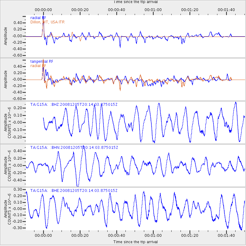
G15A Dillon, MT, USA - Earthquake Result Viewer
*The percent match for this event was below the threshold and hence no stack was calculated.
| Earthquake location: |
Off East Coast Of Honshu, Japan |
| Earthquake latitude/longitude: |
38.5/143.0 |
| Earthquake time(UTC): |
2008/12/05 (340) 20:03:11 GMT |
| Earthquake Depth: |
34 km |
| Earthquake Magnitude: |
5.5 MW, 5.2 MS, 5.2 MB, 5.5 MW |
| Earthquake Catalog/Contributor: |
WHDF/NEIC |
|
| Network: |
TA USArray Transportable Network (new EarthScope stations) |
| Station: |
G15A Dillon, MT, USA |
| Lat/Lon: |
45.17 N/112.49 W |
| Elevation: |
1857 m |
|
| Distance: |
72.6 deg |
| Az: |
45.874 deg |
| Baz: |
307.266 deg |
| Ray Param: |
$rayparam |
*The percent match for this event was below the threshold and hence was not used in the summary stack. |
|
| Radial Match: |
63.00692 % |
| Radial Bump: |
400 |
| Transverse Match: |
69.215744 % |
| Transverse Bump: |
400 |
| SOD ConfigId: |
2658 |
| Insert Time: |
2010-03-06 19:04:45.723 +0000 |
| GWidth: |
2.5 |
| Max Bumps: |
400 |
| Tol: |
0.001 |
|
Signal To Noise
| Channel | StoN | STA | LTA |
| TA:G15A: :BHN:20081205T20:14:03.875015Z | 0.61820126 | 8.172663E-8 | 1.3220068E-7 |
| TA:G15A: :BHE:20081205T20:14:03.875015Z | 1.5897855 | 1.9849836E-7 | 1.2485859E-7 |
| TA:G15A: :BHZ:20081205T20:14:03.875015Z | 1.795183 | 1.8200019E-7 | 1.0138253E-7 |
| Arrivals |
| Ps | |
| PpPs | |
| PsPs/PpSs | |


