You are here: Home > Network List > TA - USArray Transportable Network (new EarthScope stations) Stations List
> Station G15A Dillon, MT, USA > Earthquake Result Viewer
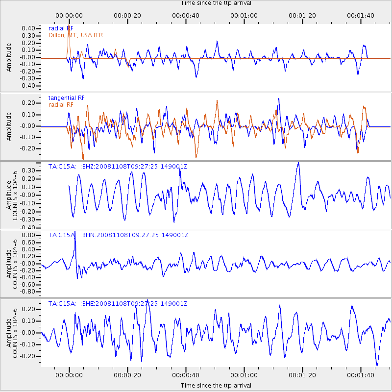
G15A Dillon, MT, USA - Earthquake Result Viewer
*The percent match for this event was below the threshold and hence no stack was calculated.
| Earthquake location: |
Tonga Islands |
| Earthquake latitude/longitude: |
-15.2/-174.2 |
| Earthquake time(UTC): |
2008/11/08 (313) 09:15:51 GMT |
| Earthquake Depth: |
140 km |
| Earthquake Magnitude: |
5.5 MW, 5.3 MB |
| Earthquake Catalog/Contributor: |
WHDF/NEIC |
|
| Network: |
TA USArray Transportable Network (new EarthScope stations) |
| Station: |
G15A Dillon, MT, USA |
| Lat/Lon: |
45.17 N/112.49 W |
| Elevation: |
1857 m |
|
| Distance: |
82.0 deg |
| Az: |
38.986 deg |
| Baz: |
239.152 deg |
| Ray Param: |
$rayparam |
*The percent match for this event was below the threshold and hence was not used in the summary stack. |
|
| Radial Match: |
47.71755 % |
| Radial Bump: |
400 |
| Transverse Match: |
48.52712 % |
| Transverse Bump: |
400 |
| SOD ConfigId: |
2658 |
| Insert Time: |
2010-03-06 19:05:00.565 +0000 |
| GWidth: |
2.5 |
| Max Bumps: |
400 |
| Tol: |
0.001 |
|
Signal To Noise
| Channel | StoN | STA | LTA |
| TA:G15A: :BHN:20081108T09:27:25.149001Z | 2.9678283 | 2.962937E-7 | 9.98352E-8 |
| TA:G15A: :BHE:20081108T09:27:25.149001Z | 1.1374462 | 9.901789E-8 | 8.705281E-8 |
| TA:G15A: :BHZ:20081108T09:27:25.149001Z | 0.38774672 | 5.978824E-8 | 1.5419407E-7 |
| Arrivals |
| Ps | |
| PpPs | |
| PsPs/PpSs | |


