You are here: Home > Network List > G - GEOSCOPE Stations List
> Station MPG Montagne des Peres, French Guyana > Earthquake Result Viewer
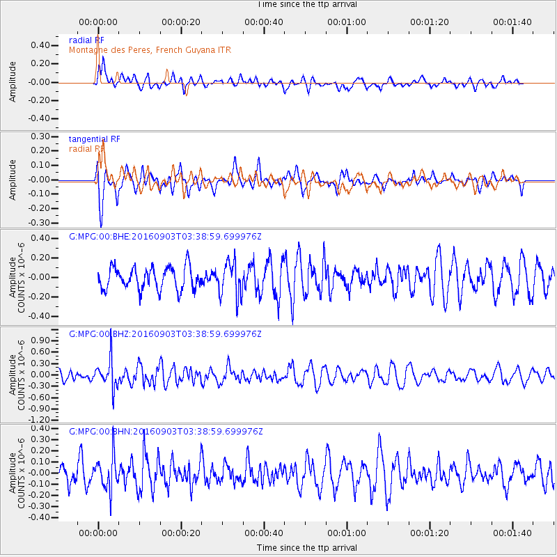
MPG Montagne des Peres, French Guyana - Earthquake Result Viewer
*The percent match for this event was below the threshold and hence no stack was calculated.
| Earthquake location: |
Off Coast Of Northern California |
| Earthquake latitude/longitude: |
40.4/-125.7 |
| Earthquake time(UTC): |
2016/09/03 (247) 03:27:55 GMT |
| Earthquake Depth: |
2.2 km |
| Earthquake Magnitude: |
5.6 MW, 5.6 MW, 5.7 MI, 5.7 MWP |
| Earthquake Catalog/Contributor: |
NEIC PDE/NEIC COMCAT |
|
| Network: |
G GEOSCOPE |
| Station: |
MPG Montagne des Peres, French Guyana |
| Lat/Lon: |
5.11 N/52.64 W |
| Elevation: |
147 m |
|
| Distance: |
73.8 deg |
| Az: |
97.208 deg |
| Baz: |
310.501 deg |
| Ray Param: |
$rayparam |
*The percent match for this event was below the threshold and hence was not used in the summary stack. |
|
| Radial Match: |
50.81714 % |
| Radial Bump: |
400 |
| Transverse Match: |
64.880844 % |
| Transverse Bump: |
400 |
| SOD ConfigId: |
1634031 |
| Insert Time: |
2016-09-17 03:32:55.783 +0000 |
| GWidth: |
2.5 |
| Max Bumps: |
400 |
| Tol: |
0.001 |
|
Signal To Noise
| Channel | StoN | STA | LTA |
| G:MPG:00:BHZ:20160903T03:38:59.699976Z | 3.3160937 | 3.829934E-7 | 1.1549535E-7 |
| G:MPG:00:BHN:20160903T03:38:59.699976Z | 2.1660955 | 1.5254932E-7 | 7.042594E-8 |
| G:MPG:00:BHE:20160903T03:38:59.699976Z | 1.6391094 | 1.8617843E-7 | 1.13585116E-7 |
| Arrivals |
| Ps | |
| PpPs | |
| PsPs/PpSs | |


