You are here: Home > Network List > TA - USArray Transportable Network (new EarthScope stations) Stations List
> Station M31M Drury Creek, Yukon, CA > Earthquake Result Viewer
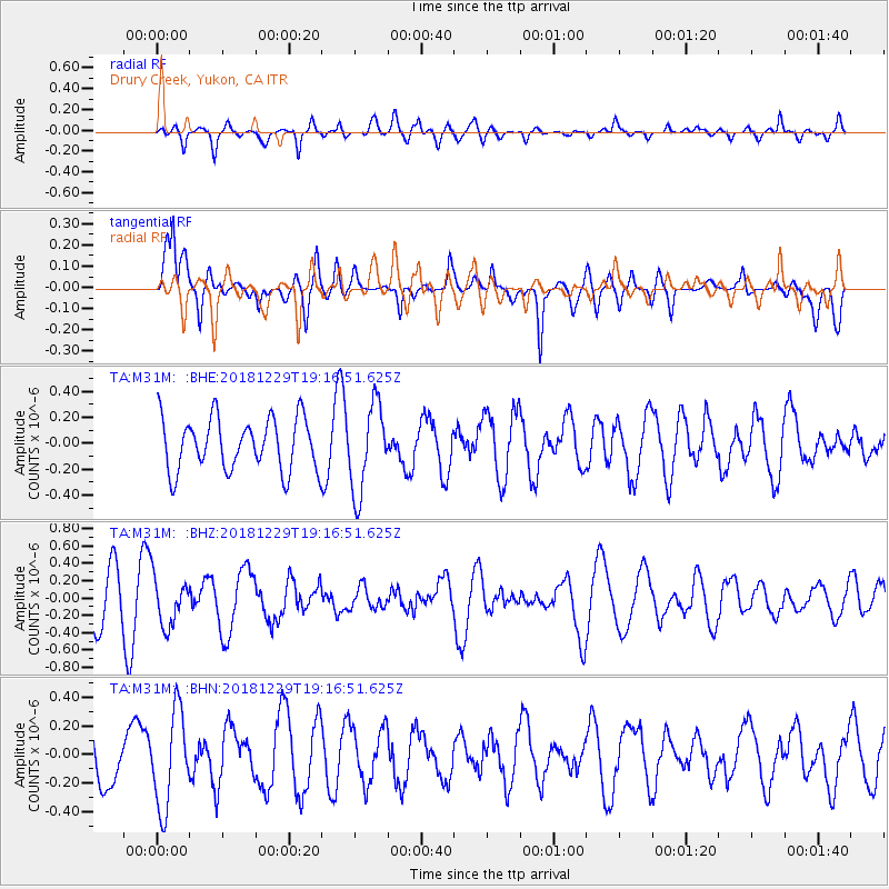
M31M Drury Creek, Yukon, CA - Earthquake Result Viewer
*The percent match for this event was below the threshold and hence no stack was calculated.
| Earthquake location: |
Hokkaido, Japan Region |
| Earthquake latitude/longitude: |
42.3/143.2 |
| Earthquake time(UTC): |
2018/12/29 (363) 19:08:30 GMT |
| Earthquake Depth: |
58 km |
| Earthquake Magnitude: |
5.5 mb |
| Earthquake Catalog/Contributor: |
NEIC PDE/us |
|
| Network: |
TA USArray Transportable Network (new EarthScope stations) |
| Station: |
M31M Drury Creek, Yukon, CA |
| Lat/Lon: |
62.20 N/134.39 W |
| Elevation: |
639 m |
|
| Distance: |
50.4 deg |
| Az: |
37.12 deg |
| Baz: |
287.169 deg |
| Ray Param: |
$rayparam |
*The percent match for this event was below the threshold and hence was not used in the summary stack. |
|
| Radial Match: |
57.778908 % |
| Radial Bump: |
400 |
| Transverse Match: |
62.12424 % |
| Transverse Bump: |
400 |
| SOD ConfigId: |
13570011 |
| Insert Time: |
2019-05-02 05:28:52.376 +0000 |
| GWidth: |
2.5 |
| Max Bumps: |
400 |
| Tol: |
0.001 |
|
Signal To Noise
| Channel | StoN | STA | LTA |
| TA:M31M: :BHZ:20181229T19:16:51.625Z | 1.0138897 | 2.7114004E-7 | 2.674256E-7 |
| TA:M31M: :BHN:20181229T19:16:51.625Z | 1.7805357 | 3.3178029E-7 | 1.8633735E-7 |
| TA:M31M: :BHE:20181229T19:16:51.625Z | 1.7659186 | 3.5100032E-7 | 1.9876359E-7 |
| Arrivals |
| Ps | |
| PpPs | |
| PsPs/PpSs | |


