You are here: Home > Network List > TJ - Tajikistan National Seismic Network Stations List
> Station GARM Garm, Tajikistan > Earthquake Result Viewer
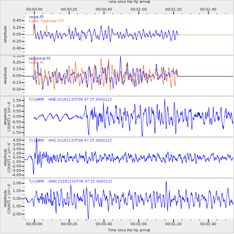
GARM Garm, Tajikistan - Earthquake Result Viewer
*The percent match for this event was below the threshold and hence no stack was calculated.
| Earthquake location: |
Southern Sumatra, Indonesia |
| Earthquake latitude/longitude: |
-2.7/102.3 |
| Earthquake time(UTC): |
2018/12/30 (364) 08:39:12 GMT |
| Earthquake Depth: |
168 km |
| Earthquake Magnitude: |
5.8 Mww |
| Earthquake Catalog/Contributor: |
NEIC PDE/us |
|
| Network: |
TJ Tajikistan National Seismic Network |
| Station: |
GARM Garm, Tajikistan |
| Lat/Lon: |
39.00 N/70.32 E |
| Elevation: |
1305 m |
|
| Distance: |
50.9 deg |
| Az: |
327.809 deg |
| Baz: |
136.923 deg |
| Ray Param: |
$rayparam |
*The percent match for this event was below the threshold and hence was not used in the summary stack. |
|
| Radial Match: |
58.18847 % |
| Radial Bump: |
400 |
| Transverse Match: |
63.8748 % |
| Transverse Bump: |
400 |
| SOD ConfigId: |
13570011 |
| Insert Time: |
2019-05-02 05:34:25.104 +0000 |
| GWidth: |
2.5 |
| Max Bumps: |
400 |
| Tol: |
0.001 |
|
Signal To Noise
| Channel | StoN | STA | LTA |
| TJ:GARM: :HHZ:20181230T08:47:25.900012Z | 12.488047 | 1.8229895E-6 | 1.4597876E-7 |
| TJ:GARM: :HHN:20181230T08:47:25.900012Z | 3.047126 | 4.8881515E-7 | 1.6041841E-7 |
| TJ:GARM: :HHE:20181230T08:47:25.900012Z | 3.7679198 | 6.704837E-7 | 1.7794532E-7 |
| Arrivals |
| Ps | |
| PpPs | |
| PsPs/PpSs | |


