V21A Milan, NM, USA - Earthquake Result Viewer
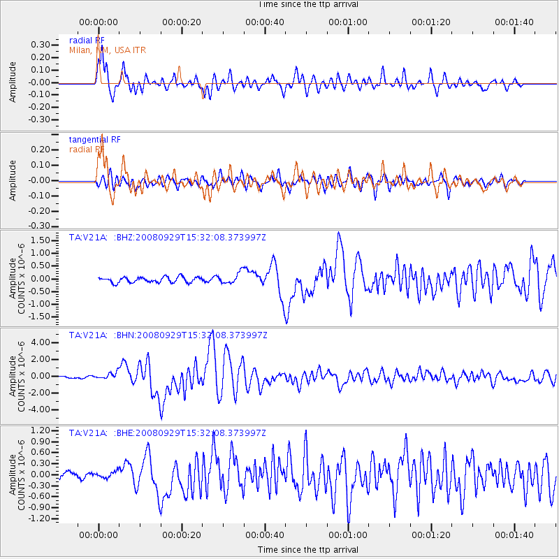
Earthquake location: Kermadec Islands, New Zealand
Earthquake latitude/longitude: -29.8/-177.7
Earthquake time(UTC): 2008/09/29 (273) 15:19:31 GMT
Earthquake Depth: 36 km
Earthquake Magnitude: 6.5 MB, 6.7 MS, 7.0 MW, 7.0 MW
Earthquake Catalog/Contributor: WHDF/NEIC
Network: TA USArray Transportable Network (new EarthScope stations)
Station: V21A Milan, NM, USA
Lat/Lon: 35.81 N/107.64 W
Elevation: 2046 m
Distance: 92.7 deg
Az: 49.897 deg
Baz: 234.91 deg
Ray Param: 0.041402344
Estimated Moho Depth: 14.0 km
Estimated Crust Vp/Vs: 1.88
Assumed Crust Vp: 6.502 km/s
Estimated Crust Vs: 3.463 km/s
Estimated Crust Poisson's Ratio: 0.30
Radial Match: 93.08534 %
Radial Bump: 400
Transverse Match: 82.318306 %
Transverse Bump: 400
SOD ConfigId: 2560
Insert Time: 2010-03-06 19:05:51.671 +0000
GWidth: 2.5
Max Bumps: 400
Tol: 0.001

Signal To Noise

ChannelStoNSTALTA
TA:V21A: :BHN:20080929T15:32:08.373997Z4.75205234.1544973E-78.742532E-8
TA:V21A: :BHE:20080929T15:32:08.373997Z0.542799068.492839E-81.5646377E-7
TA:V21A: :BHZ:20080929T15:32:08.373997Z2.12272762.2746244E-71.0715573E-7
Arrivals
Ps1.9 SECOND
PpPs6.1 SECOND
PsPs/PpSs8.0 SECOND