You are here: Home > Network List > TS - TERRAscope (Southern California Seismic Network) Stations List
> Station CALB Calabasas, California, USA > Earthquake Result Viewer
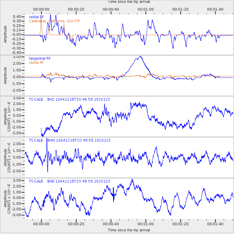
CALB Calabasas, California, USA - Earthquake Result Viewer
*The percent match for this event was below the threshold and hence no stack was calculated.
| Earthquake location: |
Fiji Islands Region |
| Earthquake latitude/longitude: |
-17.9/-178.7 |
| Earthquake time(UTC): |
1994/12/18 (352) 20:38:32 GMT |
| Earthquake Depth: |
551 km |
| Earthquake Magnitude: |
5.6 MB, 5.8 UNKNOWN, 5.7 MW |
| Earthquake Catalog/Contributor: |
WHDF/NEIC |
|
| Network: |
TS TERRAscope (Southern California Seismic Network) |
| Station: |
CALB Calabasas, California, USA |
| Lat/Lon: |
34.14 N/118.63 W |
| Elevation: |
0.0 m |
|
| Distance: |
77.1 deg |
| Az: |
47.515 deg |
| Baz: |
237.87 deg |
| Ray Param: |
$rayparam |
*The percent match for this event was below the threshold and hence was not used in the summary stack. |
|
| Radial Match: |
54.3723 % |
| Radial Bump: |
400 |
| Transverse Match: |
26.660564 % |
| Transverse Bump: |
400 |
| SOD ConfigId: |
4480 |
| Insert Time: |
2010-02-26 14:03:08.901 +0000 |
| GWidth: |
2.5 |
| Max Bumps: |
400 |
| Tol: |
0.001 |
|
Signal To Noise
| Channel | StoN | STA | LTA |
| TS:CALB: :BHN:19941218T20:48:58.162012Z | 1.8468827 | 8.7257666E-7 | 4.724592E-7 |
| TS:CALB: :BHE:19941218T20:48:58.162012Z | 0.6863531 | 1.8787379E-6 | 2.7372762E-6 |
| TS:CALB: :BHZ:19941218T20:48:58.162012Z | 0.8098912 | 1.23701E-6 | 1.527378E-6 |
| Arrivals |
| Ps | |
| PpPs | |
| PsPs/PpSs | |


