You are here: Home > Network List > CI - Caltech Regional Seismic Network Stations List
> Station BAR Barrett, Tecate, CA, USA > Earthquake Result Viewer
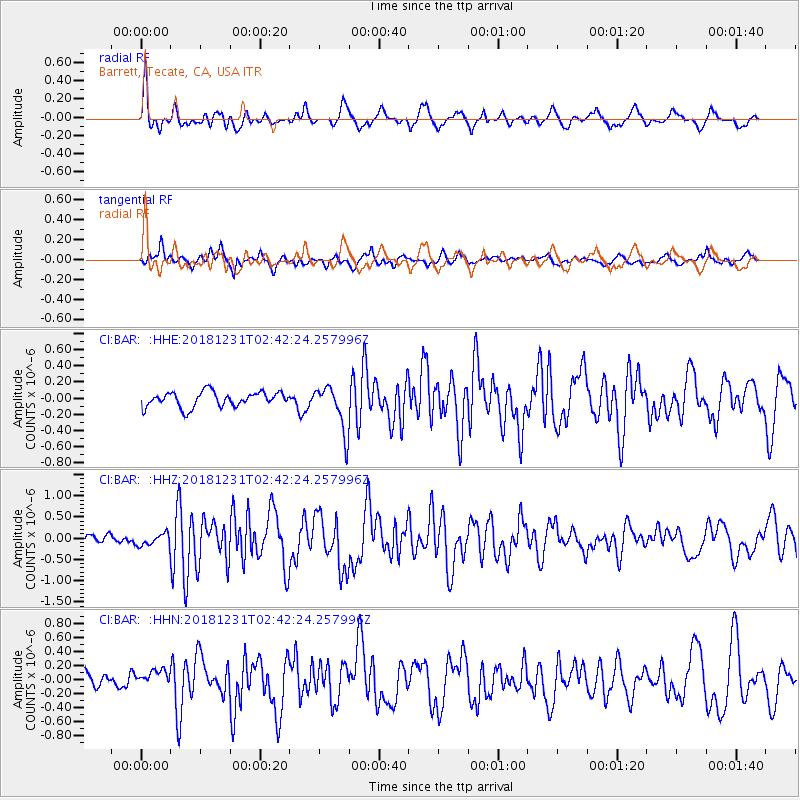
BAR Barrett, Tecate, CA, USA - Earthquake Result Viewer
*The percent match for this event was below the threshold and hence no stack was calculated.
| Earthquake location: |
Alaska Peninsula |
| Earthquake latitude/longitude: |
54.3/-161.4 |
| Earthquake time(UTC): |
2018/12/31 (365) 02:35:38 GMT |
| Earthquake Depth: |
34 km |
| Earthquake Magnitude: |
5.8 Mi |
| Earthquake Catalog/Contributor: |
NEIC PDE/at |
|
| Network: |
CI Caltech Regional Seismic Network |
| Station: |
BAR Barrett, Tecate, CA, USA |
| Lat/Lon: |
32.68 N/116.67 W |
| Elevation: |
521 m |
|
| Distance: |
38.1 deg |
| Az: |
105.961 deg |
| Baz: |
318.023 deg |
| Ray Param: |
$rayparam |
*The percent match for this event was below the threshold and hence was not used in the summary stack. |
|
| Radial Match: |
79.86546 % |
| Radial Bump: |
400 |
| Transverse Match: |
66.87758 % |
| Transverse Bump: |
400 |
| SOD ConfigId: |
13570011 |
| Insert Time: |
2019-05-02 05:36:28.493 +0000 |
| GWidth: |
2.5 |
| Max Bumps: |
400 |
| Tol: |
0.001 |
|
Signal To Noise
| Channel | StoN | STA | LTA |
| CI:BAR: :HHZ:20181231T02:42:24.257996Z | 1.0265588 | 1.5461562E-7 | 1.5061545E-7 |
| CI:BAR: :HHN:20181231T02:42:24.257996Z | 1.0416433 | 1.3621694E-7 | 1.307712E-7 |
| CI:BAR: :HHE:20181231T02:42:24.257996Z | 1.646294 | 1.5581215E-7 | 9.464418E-8 |
| Arrivals |
| Ps | |
| PpPs | |
| PsPs/PpSs | |


